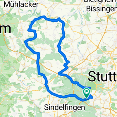
Ditzingen-Leonberg-Katzenbacher Hof
A cycling route starting in Sindelfingen, Baden-Wurttemberg, Germany.
Overview
About this route
From Katzenbacher Hof, it is a gentle uphill ride on gravel paths before steeply descending to Glemseck. The path runs along the Glems toward Leo-Bad and through Eltingen. Passing the new construction area of Leonberg-Ezach, it leads to the train station. From the station, one descends back to the Glems and follows the riverbank on paved paths, passing Höfingen. There, the route continues past the sports facilities to Tonmühle and onto Ditzingen.
- -:--
- Duration
- 21.8 km
- Distance
- 192 m
- Ascent
- 337 m
- Descent
- ---
- Avg. speed
- ---
- Max. altitude
Route quality
Waytypes & surfaces along the route
Waytypes
Track
9.6 km
(44 %)
Access road
3.9 km
(18 %)
Surfaces
Paved
17.4 km
(80 %)
Unpaved
4.1 km
(19 %)
Asphalt
17 km
(78 %)
Loose gravel
2.2 km
(10 %)
Continue with Bikemap
Use, edit, or download this cycling route
You would like to ride Ditzingen-Leonberg-Katzenbacher Hof or customize it for your own trip? Here is what you can do with this Bikemap route:
Free features
- Save this route as favorite or in collections
- Copy & plan your own version of this route
- Sync your route with Garmin or Wahoo
Premium features
Free trial for 3 days, or one-time payment. More about Bikemap Premium.
- Navigate this route on iOS & Android
- Export a GPX / KML file of this route
- Create your custom printout (try it for free)
- Download this route for offline navigation
Discover more Premium features.
Get Bikemap PremiumFrom our community
Other popular routes starting in Sindelfingen
 Kurze Runde um BB (62,5km)
- Distance
- 62.5 km
- Ascent
- 454 m
- Descent
- 439 m
- Location
- Sindelfingen, Baden-Wurttemberg, Germany
 Parkhotel Leinfelden Echterdingen und Siebenmühlental
- Distance
- 30 km
- Ascent
- 302 m
- Descent
- 302 m
- Location
- Sindelfingen, Baden-Wurttemberg, Germany
 Sifi - Magstadt - Renningen/Weinberg - Malmsheim - Weil d. Stadt - Döffingen - Sifi
- Distance
- 36.6 km
- Ascent
- 196 m
- Descent
- 196 m
- Location
- Sindelfingen, Baden-Wurttemberg, Germany
 Sindelfingen-Siebenmühlental
- Distance
- 25.1 km
- Ascent
- 215 m
- Descent
- 226 m
- Location
- Sindelfingen, Baden-Wurttemberg, Germany
 S-Vaihingen Renningen Mönse Iptingen Gr-Glattbach Enzweihingen Heimse Leo
- Distance
- 79.4 km
- Ascent
- 878 m
- Descent
- 975 m
- Location
- Sindelfingen, Baden-Wurttemberg, Germany
 Vaihingen Baerenschloessle
- Distance
- 6.2 km
- Ascent
- 94 m
- Descent
- 166 m
- Location
- Sindelfingen, Baden-Wurttemberg, Germany
 einfach drauf los
- Distance
- 36.7 km
- Ascent
- 391 m
- Descent
- 389 m
- Location
- Sindelfingen, Baden-Wurttemberg, Germany
 Lange Runde durch den Nordschwarzwald
- Distance
- 172.3 km
- Ascent
- 2,412 m
- Descent
- 2,413 m
- Location
- Sindelfingen, Baden-Wurttemberg, Germany
Open it in the app

