

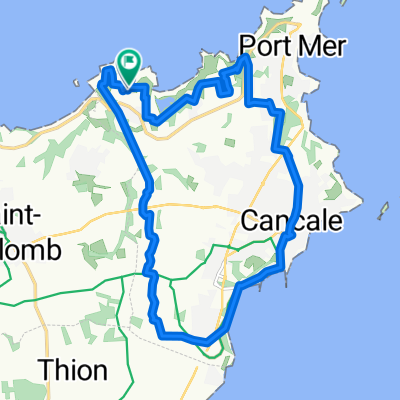
Saint Malo - Saint Alban 09.06.2013 / 2nd Stage
A cycling route starting in Saint-Coulomb, Brittany Region, France.
Overview
About this route
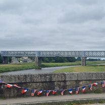
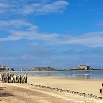
<div style="margin: 0px; padding: 0px; border: 0px; outline: 0px; color: rgb(102, 102, 102); font-family: Helvetica, 'Helvetica Neue', Arial, sans-serif; line-height: 20px;"> <div style="margin: 0px; padding: 0px; border: 0px; outline: 0px;"> Cesta zpevněná po silnici, občas polní a tomu podobné cesty.</div> <div style="margin: 0px; padding: 0px; border: 0px; outline: 0px;"> </div> <div style="margin: 0px; padding: 0px; border: 0px; outline: 0px;"> Zajímavosti na trase :</div> <div style="margin: 0px; padding: 0px; border: 0px; outline: 0px;"> - 58.km : Fort la Latte (Château de la Roche)</div> <div style="margin: 0px; padding: 0px; border: 0px; outline: 0px;"> - 63.km : mys (výběžek) + maják Le Cap Fréhel</div> <div style="margin: 0px; padding: 0px; border: 0px; outline: 0px;"> - 86.km : Château Bien Assis</div> <div style="margin: 0px; padding: 0px; border: 0px; outline: 0px;"> </div> <div style="margin: 0px; padding: 0px; border: 0px; outline: 0px;"> Údaje z cyklocomputeru:</div> <div style="margin: 0px; padding: 0px; border: 0px; outline: 0px;"> délka 93,71 km / nastoupáno 992 m / čas 5:08:37 hod</div> <div style="margin: 0px; padding: 0px; border: 0px; outline: 0px;"> </div> <div style="margin: 0px; padding: 0px; border: 0px; outline: 0px;"> Kemp Saint Alban:</div> <div style="margin: 0px; padding: 0px; border: 0px; outline: 0px;"> čistý udržovaný kemp, teplá voda, stojan s elektrikou za poplatek, venkovní bazén (byl zavřen a asi i pěkně studený)</div> </div>
- -:--
- Duration
- 92.3 km
- Distance
- 436 m
- Ascent
- 381 m
- Descent
- ---
- Avg. speed
- ---
- Max. altitude

Route quality
Waytypes & surfaces along the route
Waytypes
Quiet road
35.1 km
(38 %)
Road
16.6 km
(18 %)
Surfaces
Paved
46.2 km
(50 %)
Unpaved
5.5 km
(6 %)
Asphalt
42.5 km
(46 %)
Gravel
3.7 km
(4 %)
Continue with Bikemap
Use, edit, or download this cycling route
You would like to ride Saint Malo - Saint Alban 09.06.2013 / 2nd Stage or customize it for your own trip? Here is what you can do with this Bikemap route:
Free features
- Save this route as favorite or in collections
- Copy & plan your own version of this route
- Split it into stages to create a multi-day tour
- Sync your route with Garmin or Wahoo
Premium features
Free trial for 3 days, or one-time payment. More about Bikemap Premium.
- Navigate this route on iOS & Android
- Export a GPX / KML file of this route
- Create your custom printout (try it for free)
- Download this route for offline navigation
Discover more Premium features.
Get Bikemap PremiumFrom our community
Other popular routes starting in Saint-Coulomb
 Saint Malo - Saint Alban 09.06.2013 / 2nd Stage
- Distance
- 92.3 km
- Ascent
- 436 m
- Descent
- 381 m
- Location
- Saint-Coulomb, Brittany Region, France
 La Haute Marette to Pontorson
- Distance
- 40.7 km
- Ascent
- 65 m
- Descent
- 80 m
- Location
- Saint-Coulomb, Brittany Region, France
 Frankreich 2022 - Bretagne 3a
- Distance
- 42.7 km
- Ascent
- 62 m
- Descent
- 83 m
- Location
- Saint-Coulomb, Brittany Region, France
 37 Rue de la Guimorais, Saint-Coulomb à 6 Rue des Saules, La Fresnais
- Distance
- 16.3 km
- Ascent
- 64 m
- Descent
- 75 m
- Location
- Saint-Coulomb, Brittany Region, France
 De 9C Rue du Moulin du Gué, Saint-Malo à 28 Rue du Moulin du Gué, Saint-Malo
- Distance
- 25.5 km
- Ascent
- 13 m
- Descent
- 52 m
- Location
- Saint-Coulomb, Brittany Region, France
 cancale n°1
- Distance
- 15.9 km
- Ascent
- 664 m
- Descent
- 660 m
- Location
- Saint-Coulomb, Brittany Region, France
 Tag 20: Normandie 1
- Distance
- 70.2 km
- Ascent
- 215 m
- Descent
- 249 m
- Location
- Saint-Coulomb, Brittany Region, France
 Rue de la Salinette 13, Saint-Malo nach Rue de la Salinette 13, Saint-Malo
- Distance
- 13.8 km
- Ascent
- 132 m
- Descent
- 131 m
- Location
- Saint-Coulomb, Brittany Region, France
Open it in the app