Puertolapice
A cycling route starting in Puerto Lápice, Castille-La Mancha, Spain.
Overview
About this route
Ruta por montes, tres ascensiones
- -:--
- Duration
- 58 km
- Distance
- 673 m
- Ascent
- 673 m
- Descent
- ---
- Avg. speed
- ---
- Avg. speed
Route quality
Waytypes & surfaces along the route
Waytypes
Track
48.4 km
(84 %)
Road
6.7 km
(11 %)
Surfaces
Paved
2.5 km
(4 %)
Unpaved
48.4 km
(83 %)
Gravel
31.3 km
(54 %)
Ground
17 km
(29 %)
Continue with Bikemap
Use, edit, or download this cycling route
You would like to ride Puertolapice or customize it for your own trip? Here is what you can do with this Bikemap route:
Free features
- Save this route as favorite or in collections
- Copy & plan your own version of this route
- Sync your route with Garmin or Wahoo
Premium features
Free trial for 3 days, or one-time payment. More about Bikemap Premium.
- Navigate this route on iOS & Android
- Export a GPX / KML file of this route
- Create your custom printout (try it for free)
- Download this route for offline navigation
Discover more Premium features.
Get Bikemap PremiumFrom our community
Other popular routes starting in Puerto Lápice
- sierra de madridejos
- Distance
- 46.2 km
- Ascent
- 763 m
- Descent
- 762 m
- Location
- Puerto Lápice, Castille-La Mancha, Spain
- Puerto Lápice a Campo de Criptana
- Distance
- 35.4 km
- Ascent
- 138 m
- Descent
- 99 m
- Location
- Puerto Lápice, Castille-La Mancha, Spain
- JJ desde Puerto
- Distance
- 92.1 km
- Ascent
- 1,779 m
- Descent
- 1,782 m
- Location
- Puerto Lápice, Castille-La Mancha, Spain
- 4. Puerto Lápice - Tomelloso
- Distance
- 74.6 km
- Ascent
- 230 m
- Descent
- 243 m
- Location
- Puerto Lápice, Castille-La Mancha, Spain
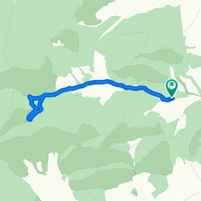
- Puerto Lapice-Valdehierro- El vasto-El cenicero-Molinos-Puerto Lapice
- Distance
- 32.9 km
- Ascent
- 716 m
- Descent
- 716 m
- Location
- Puerto Lápice, Castille-La Mancha, Spain
- Puerto Lapice - Sierra Luenga - Sendas de los Molinos
- Distance
- 68.1 km
- Ascent
- 978 m
- Descent
- 977 m
- Location
- Puerto Lápice, Castille-La Mancha, Spain
- PuertoLapice-CuatroCaminos-CasaForestales-PuertoLapice
- Distance
- 48.5 km
- Ascent
- 494 m
- Descent
- 493 m
- Location
- Puerto Lápice, Castille-La Mancha, Spain
- Puerto Lápice - Sierra Luenga
- Distance
- 45.7 km
- Ascent
- 548 m
- Descent
- 548 m
- Location
- Puerto Lápice, Castille-La Mancha, Spain
Open it in the app