

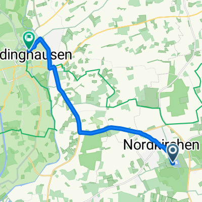
Nordkirchen - LH Klutenseebad
A cycling route starting in Nordkirchen, North Rhine-Westphalia, Germany.
Overview
About this route
From Nordkirchen to Lüdinghausen to the Klutenseebad and/or back, at the Klutenseebad still 2 km of swimming
- -:--
- Duration
- 10 km
- Distance
- 10 m
- Ascent
- 28 m
- Descent
- ---
- Avg. speed
- ---
- Max. altitude

Route quality
Waytypes & surfaces along the route
Waytypes
Quiet road
2.9 km
(29 %)
Path
1.3 km
(13 %)
Surfaces
Paved
9.8 km
(98 %)
Asphalt
9.7 km
(97 %)
Paved (undefined)
0.1 km
(1 %)
Undefined
0.2 km
(2 %)
Continue with Bikemap
Use, edit, or download this cycling route
You would like to ride Nordkirchen - LH Klutenseebad or customize it for your own trip? Here is what you can do with this Bikemap route:
Free features
- Save this route as favorite or in collections
- Copy & plan your own version of this route
- Sync your route with Garmin or Wahoo
Premium features
Free trial for 3 days, or one-time payment. More about Bikemap Premium.
- Navigate this route on iOS & Android
- Export a GPX / KML file of this route
- Create your custom printout (try it for free)
- Download this route for offline navigation
Discover more Premium features.
Get Bikemap PremiumFrom our community
Other popular routes starting in Nordkirchen
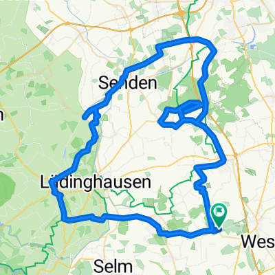
 Tag 1 nordkirchen nach Lüdinghausen
- Distance
- 10.4 km
- Ascent
- 25 m
- Descent
- 36 m
- Location
- Nordkirchen, North Rhine-Westphalia, Germany
 Rundweg Capelle 3.5.2015
- Distance
- 34.1 km
- Ascent
- 99 m
- Descent
- 99 m
- Location
- Nordkirchen, North Rhine-Westphalia, Germany
 NK-Piekenbrock-B58-LH-Stadtwald-SchwarzerDamm-Südkirchen-Obsen
- Distance
- 31.5 km
- Ascent
- 80 m
- Descent
- 83 m
- Location
- Nordkirchen, North Rhine-Westphalia, Germany
 Nordkirchen nach Hannover
- Distance
- 271.7 km
- Ascent
- 628 m
- Descent
- 632 m
- Location
- Nordkirchen, North Rhine-Westphalia, Germany
 Feuerstiege – Schloss Nordkirchen Runde von Capelle (Westf)
- Distance
- 91.4 km
- Ascent
- 302 m
- Descent
- 301 m
- Location
- Nordkirchen, North Rhine-Westphalia, Germany
 Nordkirchen - LH Klutenseebad
- Distance
- 10 km
- Ascent
- 10 m
- Descent
- 28 m
- Location
- Nordkirchen, North Rhine-Westphalia, Germany
 Burg und Schloss-Tour
- Distance
- 136.3 km
- Ascent
- 179 m
- Descent
- 180 m
- Location
- Nordkirchen, North Rhine-Westphalia, Germany
 CTF Schlössertour 2009
- Distance
- 50.5 km
- Ascent
- 161 m
- Descent
- 161 m
- Location
- Nordkirchen, North Rhine-Westphalia, Germany
Open it in the app