

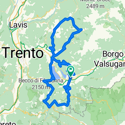
Levio Terme - Pso. Del Manghen
A cycling route starting in Levico Terme, Trentino-Alto Adige, Italy.
Overview
About this route
Tour from the 2009 training camp in Levico Terme (Italy) to the Manghen Pass and the Vetriolo Thermal Baths Alternative descent from there: return to the junction and descend directly to Levico Terme, as the road there is much better compared to the indicated one (sand, potholes, etc.) Elevation gain approximately 3400 m
- -:--
- Duration
- 121.7 km
- Distance
- 3,588 m
- Ascent
- 2,992 m
- Descent
- ---
- Avg. speed
- 2,025 m
- Max. altitude

Route quality
Waytypes & surfaces along the route
Waytypes
Quiet road
23.1 km
(19 %)
Road
19.5 km
(16 %)
Surfaces
Paved
96.2 km
(79 %)
Asphalt
96.2 km
(79 %)
Undefined
25.6 km
(21 %)
Continue with Bikemap
Use, edit, or download this cycling route
You would like to ride Levio Terme - Pso. Del Manghen or customize it for your own trip? Here is what you can do with this Bikemap route:
Free features
- Save this route as favorite or in collections
- Copy & plan your own version of this route
- Split it into stages to create a multi-day tour
- Sync your route with Garmin or Wahoo
Premium features
Free trial for 3 days, or one-time payment. More about Bikemap Premium.
- Navigate this route on iOS & Android
- Export a GPX / KML file of this route
- Create your custom printout (try it for free)
- Download this route for offline navigation
Discover more Premium features.
Get Bikemap PremiumFrom our community
Other popular routes starting in Levico Terme
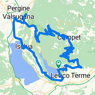 4. tag Rund um Levico Terme
- Distance
- 36 km
- Ascent
- 1,189 m
- Descent
- 1,192 m
- Location
- Levico Terme, Trentino-Alto Adige, Italy
 2018_september_step_03
- Distance
- 131.1 km
- Ascent
- 685 m
- Descent
- 1,154 m
- Location
- Levico Terme, Trentino-Alto Adige, Italy
 Hotel Eden- Pannarotta
- Distance
- 16.3 km
- Ascent
- 1,308 m
- Descent
- 39 m
- Location
- Levico Terme, Trentino-Alto Adige, Italy
 22/08/2020 Da Località Pleina 5, Levico Terme a Località Pleina 5, Levico Terme
- Distance
- 29.5 km
- Ascent
- 343 m
- Descent
- 340 m
- Location
- Levico Terme, Trentino-Alto Adige, Italy
 Levico - Levico
- Distance
- 110.5 km
- Ascent
- 2,698 m
- Descent
- 2,698 m
- Location
- Levico Terme, Trentino-Alto Adige, Italy
 Tour um Lago Caldonezzo+Levico
- Distance
- 27.3 km
- Ascent
- 309 m
- Descent
- 309 m
- Location
- Levico Terme, Trentino-Alto Adige, Italy
 Panarotte via Kamauz
- Distance
- 55.1 km
- Ascent
- 1,721 m
- Descent
- 1,722 m
- Location
- Levico Terme, Trentino-Alto Adige, Italy
 Levio Terme - Pso. Del Manghen
- Distance
- 121.7 km
- Ascent
- 3,588 m
- Descent
- 2,992 m
- Location
- Levico Terme, Trentino-Alto Adige, Italy
Open it in the app