Neuotting-Mutenin
- 195.4 km
- 860 m
- 749 m
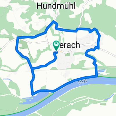
- Perach, Bavaria, Germany
A cycling route starting in Perach, Bavaria, Germany.
Overview
Loop tour over rather flat land (except for one spot [Magarethenberg]), mostly paved.
created this 12 years ago
Route quality
Track
25.5 km
46 %
Quiet road
21.1 km
38 %
Paved
26.6 km
(48 %)
Unpaved
22.2 km
(40 %)
Asphalt
24.9 km
45 %
Gravel
15 km
27 %
Continue with Bikemap
You would like to ride Rundreise 2013 or customize it for your own trip? Here is what you can do with this Bikemap route:
Free trial for 3 days, or one-time payment. More about Bikemap Premium.
Discover more Premium features.
Get Bikemap PremiumFrom our community
Open it in the app