

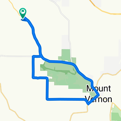
Mt. Vernon 23 miler
A cycling route starting in Mount Horeb, Wisconsin, United States.
Overview
About this route
The medium length ride (22.8mi) from the Wednesday Night Bike Ride group.
- -:--
- Duration
- 31.7 km
- Distance
- 291 m
- Ascent
- 291 m
- Descent
- ---
- Avg. speed
- ---
- Max. altitude
Route quality
Waytypes & surfaces along the route
Waytypes
Road
18.4 km
(58 %)
Quiet road
13 km
(41 %)
Undefined
0.3 km
(1 %)
Surfaces
Paved
18.7 km
(59 %)
Asphalt
18.7 km
(59 %)
Undefined
13 km
(41 %)
Continue with Bikemap
Use, edit, or download this cycling route
You would like to ride Mt. Vernon 23 miler or customize it for your own trip? Here is what you can do with this Bikemap route:
Free features
- Save this route as favorite or in collections
- Copy & plan your own version of this route
- Sync your route with Garmin or Wahoo
Premium features
Free trial for 3 days, or one-time payment. More about Bikemap Premium.
- Navigate this route on iOS & Android
- Export a GPX / KML file of this route
- Create your custom printout (try it for free)
- Download this route for offline navigation
Discover more Premium features.
Get Bikemap PremiumFrom our community
Other popular routes starting in Mount Horeb
 2411 WIS-92, Mount Horeb to 2411 WIS-92, Mount Horeb
- Distance
- 16.5 km
- Ascent
- 220 m
- Descent
- 221 m
- Location
- Mount Horeb, Wisconsin, United States
 Short Mt Horeb
- Distance
- 17.4 km
- Ascent
- 116 m
- Descent
- 115 m
- Location
- Mount Horeb, Wisconsin, United States
 Mount Horeb Cycling
- Distance
- 17.5 km
- Ascent
- 50 m
- Descent
- 81 m
- Location
- Mount Horeb, Wisconsin, United States
 Bingham County Park 22 miler WNBR
- Distance
- 36 km
- Ascent
- 428 m
- Descent
- 428 m
- Location
- Mount Horeb, Wisconsin, United States
 Mount Horeb Cycling
- Distance
- 57.5 km
- Ascent
- 558 m
- Descent
- 582 m
- Location
- Mount Horeb, Wisconsin, United States
 Topsy turvy Tyrol tour
- Distance
- 41.6 km
- Ascent
- 539 m
- Descent
- 536 m
- Location
- Mount Horeb, Wisconsin, United States
 High-speed route in Mount Horeb
- Distance
- 44.6 km
- Ascent
- 636 m
- Descent
- 660 m
- Location
- Mount Horeb, Wisconsin, United States
 2411 WIS-92, Mount Horeb to 2411 WIS-92, Mount Horeb
- Distance
- 35.7 km
- Ascent
- 258 m
- Descent
- 262 m
- Location
- Mount Horeb, Wisconsin, United States
Open it in the app