
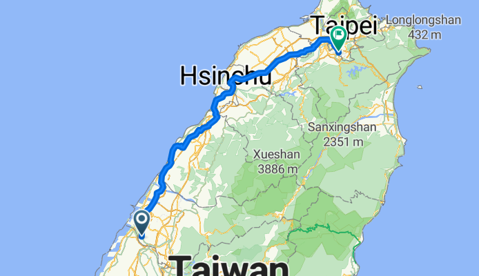
台中大肚-台北萬隆
A cycling route starting in Chang-hua, Taiwan, Taiwan.
Overview
About this route
0
台中台北探路行
- -:--
- Duration
- 182.3 km
- Distance
- 496 m
- Ascent
- 491 m
- Descent
- ---
- Avg. speed
- ---
- Max. altitude
Xin Rong Li
created this 13 years ago
Route quality
Waytypes & surfaces along the route
Waytypes
Quiet road
21.9 km
12 %
Access road
12.8 km
7 %
Surfaces
Paved
142.2 km
(78 %)
Asphalt
138.6 km
76 %
Paved (undefined)
3.6 km
2 %
Undefined
40.1 km
22 %
Continue with Bikemap
Use, edit, or download this cycling route
You would like to ride 台中大肚-台北萬隆 or customize it for your own trip? Here is what you can do with this Bikemap route:
Free features
- Save this route as favorite or in collections
- Copy & plan your own version of this route
- Split it into stages to create a multi-day tour
- Sync your route with Garmin or Wahoo
Premium features
Free trial for 3 days, or one-time payment. More about Bikemap Premium.
- Navigate this route on iOS & Android
- Export a GPX / KML file of this route
- Create your custom printout (try it for free)
- Download this route for offline navigation
Discover more Premium features.
Get Bikemap PremiumFrom our community
Other popular routes starting in Chang-hua


Open it in the app