

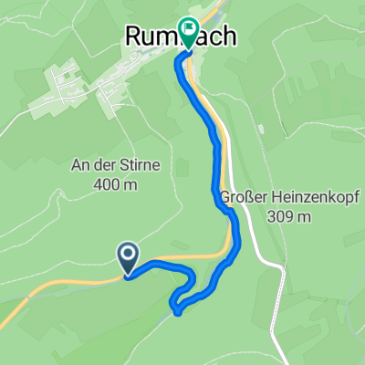
Durch Wasgau und Elsass
A cycling route starting in Rumbach, Rhineland-Palatinate, Germany.
Overview
About this route
Through the Dahner Felsenlang and the northernmost tip of Alsace
- -:--
- Duration
- 72.7 km
- Distance
- 551 m
- Ascent
- 552 m
- Descent
- ---
- Avg. speed
- ---
- Max. altitude
Route quality
Waytypes & surfaces along the route
Waytypes
Road
5.1 km
(7 %)
Quiet road
2.9 km
(4 %)
Surfaces
Paved
64 km
(88 %)
Asphalt
62.6 km
(86 %)
Paved (undefined)
1.5 km
(2 %)
Undefined
8.7 km
(12 %)
Continue with Bikemap
Use, edit, or download this cycling route
You would like to ride Durch Wasgau und Elsass or customize it for your own trip? Here is what you can do with this Bikemap route:
Free features
- Save this route as favorite or in collections
- Copy & plan your own version of this route
- Sync your route with Garmin or Wahoo
Premium features
Free trial for 3 days, or one-time payment. More about Bikemap Premium.
- Navigate this route on iOS & Android
- Export a GPX / KML file of this route
- Create your custom printout (try it for free)
- Download this route for offline navigation
Discover more Premium features.
Get Bikemap PremiumFrom our community
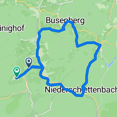
Other popular routes starting in Rumbach
 Radtour quer durch den Wasgau
- Distance
- 73.3 km
- Ascent
- 484 m
- Descent
- 484 m
- Location
- Rumbach, Rhineland-Palatinate, Germany
 Durch das Dahner Felsenland
- Distance
- 45.9 km
- Ascent
- 353 m
- Descent
- 350 m
- Location
- Rumbach, Rhineland-Palatinate, Germany
 Ortsstraße 43, Rumbach nach Geibstraße 5, Speyer
- Distance
- 83.4 km
- Ascent
- 649 m
- Descent
- 788 m
- Location
- Rumbach, Rhineland-Palatinate, Germany
 Im Langental 61, Rumbach nach Im Langental 64, Rumbach
- Distance
- 6.5 km
- Ascent
- 194 m
- Descent
- 198 m
- Location
- Rumbach, Rhineland-Palatinate, Germany
 Relaxed route in Rumbach
- Distance
- 2.5 km
- Ascent
- 31 m
- Descent
- 94 m
- Location
- Rumbach, Rhineland-Palatinate, Germany
 Ebertstraße 2, Rumbach nach Ortsstraße 68, Rumbach
- Distance
- 22.5 km
- Ascent
- 470 m
- Descent
- 444 m
- Location
- Rumbach, Rhineland-Palatinate, Germany
 Ortsstraße 52, Rumbach nach Ehrenmal des deutschen Heeres, Koblenz
- Distance
- 271 km
- Ascent
- 2,049 m
- Descent
- 2,116 m
- Location
- Rumbach, Rhineland-Palatinate, Germany
 Quer durch den Wasgau
- Distance
- 73.3 km
- Ascent
- 537 m
- Descent
- 537 m
- Location
- Rumbach, Rhineland-Palatinate, Germany
Open it in the app