

Wachenheim Kalmit Modenbachtal Ramberg
A cycling route starting in Otterstadt, Rhineland-Palatinate, Germany.
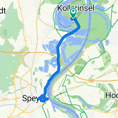
Overview
About this route
Ideal Route
(cloned from route 2196503)
- -:--
- Duration
- 137.9 km
- Distance
- 1,185 m
- Ascent
- 1,183 m
- Descent
- ---
- Avg. speed
- ---
- Max. altitude

Route quality
Waytypes & surfaces along the route
Waytypes
Road
31.7 km
(23 %)
Quiet road
19.3 km
(14 %)
Surfaces
Paved
124.2 km
(90 %)
Unpaved
4.1 km
(3 %)
Asphalt
120 km
(87 %)
Concrete
2.8 km
(2 %)
Continue with Bikemap
Use, edit, or download this cycling route
You would like to ride Wachenheim Kalmit Modenbachtal Ramberg or customize it for your own trip? Here is what you can do with this Bikemap route:
Free features
- Save this route as favorite or in collections
- Copy & plan your own version of this route
- Split it into stages to create a multi-day tour
- Sync your route with Garmin or Wahoo
Premium features
Free trial for 3 days, or one-time payment. More about Bikemap Premium.
- Navigate this route on iOS & Android
- Export a GPX / KML file of this route
- Create your custom printout (try it for free)
- Download this route for offline navigation
Discover more Premium features.
Get Bikemap PremiumFrom our community
Other popular routes starting in Otterstadt
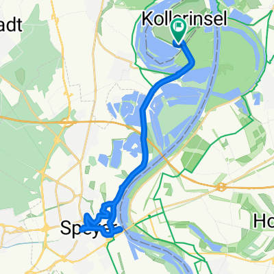
 Camping Kollersee nach Speyer zum Alten Hammer
- Distance
- 10.2 km
- Ascent
- 11 m
- Descent
- 59 m
- Location
- Otterstadt, Rhineland-Palatinate, Germany
 Umleitung_Otterstadt-Waldsee
- Distance
- 12.2 km
- Ascent
- 35 m
- Descent
- 32 m
- Location
- Otterstadt, Rhineland-Palatinate, Germany
 Camping Kollersee nach Schwetzingen Schlossgarten
- Distance
- 8.7 km
- Ascent
- 20 m
- Descent
- 67 m
- Location
- Otterstadt, Rhineland-Palatinate, Germany
 Camping Kollersee nach Camping Kollersee
- Distance
- 22.6 km
- Ascent
- 39 m
- Descent
- 91 m
- Location
- Otterstadt, Rhineland-Palatinate, Germany
 Rettich-Rhein-Tour
- Distance
- 36.1 km
- Ascent
- 56 m
- Descent
- 59 m
- Location
- Otterstadt, Rhineland-Palatinate, Germany
 Rollerski- bzw. Inlinerroute am Rheindamm Otterstadt -> Altrip
- Distance
- 8.8 km
- Ascent
- 16 m
- Descent
- 16 m
- Location
- Otterstadt, Rhineland-Palatinate, Germany
 Camping Kollersee nach Camping Kollersee
- Distance
- 19.9 km
- Ascent
- 39 m
- Descent
- 83 m
- Location
- Otterstadt, Rhineland-Palatinate, Germany
 Camping Kollersee nach Camping Kollersee
- Distance
- 20.4 km
- Ascent
- 74 m
- Descent
- 123 m
- Location
- Otterstadt, Rhineland-Palatinate, Germany
Open it in the app