

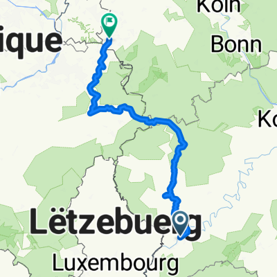
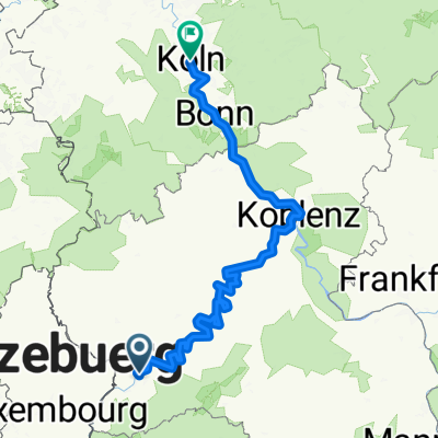
Overview
About this route
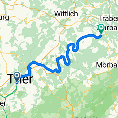
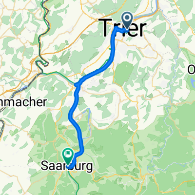
Tag 1 2016 Trier Biewer - Neufgrange, entlang an Mosel Saar und Saar Kohlenkanal
- -:--
- Duration
- 151.3 km
- Distance
- 404 m
- Ascent
- 308 m
- Descent
- ---
- Avg. speed
- ---
- Max. altitude

Part of
2016
6 stages
Route quality
Waytypes & surfaces along the route
Waytypes
Path
52.9 km
(35 %)
Access road
46.9 km
(31 %)
Surfaces
Paved
134.6 km
(89 %)
Unpaved
4.5 km
(3 %)
Asphalt
110.4 km
(73 %)
Paved (undefined)
13.6 km
(9 %)
Continue with Bikemap
Use, edit, or download this cycling route
You would like to ride 2016 1 Trier - Gotthardpass or customize it for your own trip? Here is what you can do with this Bikemap route:
Free features
- Save this route as favorite or in collections
- Copy & plan your own version of this route
- Split it into stages to create a multi-day tour
- Sync your route with Garmin or Wahoo
Premium features
Free trial for 3 days, or one-time payment. More about Bikemap Premium.
- Navigate this route on iOS & Android
- Export a GPX / KML file of this route
- Create your custom printout (try it for free)
- Download this route for offline navigation
Discover more Premium features.
Get Bikemap PremiumFrom our community
Other popular routes starting in Trier
 23_Trier – Schweich – Bernkastel-Kues
- Distance
- 67.8 km
- Ascent
- 107 m
- Descent
- 130 m
- Location
- Trier, Rhineland-Palatinate, Germany
 Mosel Radweg Day 3- Final
- Distance
- 122.1 km
- Ascent
- 511 m
- Descent
- 171 m
- Location
- Trier, Rhineland-Palatinate, Germany
 Bahnhofsplatz nach Domhof
- Distance
- 231.7 km
- Ascent
- 3,744 m
- Descent
- 3,707 m
- Location
- Trier, Rhineland-Palatinate, Germany
 Mosel - Rhein
- Distance
- 290.4 km
- Ascent
- 172 m
- Descent
- 246 m
- Location
- Trier, Rhineland-Palatinate, Germany
 Deutsch-Luxemburgische Permanente 2014 - 96 km Perm. des RV Schwalbe Trier 1932 e.V.
- Distance
- 98.4 km
- Ascent
- 312 m
- Descent
- 310 m
- Location
- Trier, Rhineland-Palatinate, Germany
 Augustiner Tour 2016 Etappe 1
- Distance
- 70.5 km
- Ascent
- 641 m
- Descent
- 328 m
- Location
- Trier, Rhineland-Palatinate, Germany
 2018 Trier - Luxemburg - Laon - Amiens - Caen - Le Mont-Saint-Michel - St.Malo - Brest - Nantes
- Distance
- 1,877.5 km
- Ascent
- 1,181 m
- Descent
- 1,299 m
- Location
- Trier, Rhineland-Palatinate, Germany
 2. Etappe - Graf-Siegfried-Straße, Saarburg nach Heinertstraße, Mettlach
- Distance
- 24.3 km
- Ascent
- 166 m
- Descent
- 139 m
- Location
- Trier, Rhineland-Palatinate, Germany
Open it in the app