

5.Bergzeitfahren Markersbach / 22.07.2017
A cycling route starting in Markersbach, Saxony, Germany.
Overview
About this route
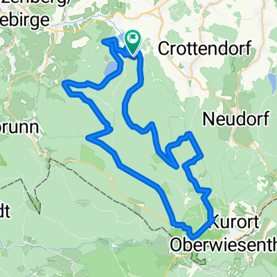
5.Bergzeitfahren Markersbach / 22.07.2017
- -:--
- Duration
- 5.2 km
- Distance
- 362 m
- Ascent
- 40 m
- Descent
- ---
- Avg. speed
- ---
- Max. altitude
Route quality
Waytypes & surfaces along the route
Waytypes
Quiet road
3.5 km
(67 %)
Road
1.7 km
(33 %)
Surfaces
Paved
5.2 km
(100 %)
Asphalt
5.2 km
(100 %)
Continue with Bikemap
Use, edit, or download this cycling route
You would like to ride 5.Bergzeitfahren Markersbach / 22.07.2017 or customize it for your own trip? Here is what you can do with this Bikemap route:
Free features
- Save this route as favorite or in collections
- Copy & plan your own version of this route
- Sync your route with Garmin or Wahoo
Premium features
Free trial for 3 days, or one-time payment. More about Bikemap Premium.
- Navigate this route on iOS & Android
- Export a GPX / KML file of this route
- Create your custom printout (try it for free)
- Download this route for offline navigation
Discover more Premium features.
Get Bikemap PremiumFrom our community
Other popular routes starting in Markersbach
 ERZ-Tour 2016 - Markersbach I - Fichtelforest (Kontrolle notwendig wegen Asphalt!)
- Distance
- 39.5 km
- Ascent
- 800 m
- Descent
- 606 m
- Location
- Markersbach, Saxony, Germany
 Erzgebirgsradrennen Makersbach
- Distance
- 45.7 km
- Ascent
- 1,058 m
- Descent
- 973 m
- Location
- Markersbach, Saxony, Germany
 Oberbecken und Hundsmarter Skatinģ Schnee
- Distance
- 12.9 km
- Ascent
- 471 m
- Descent
- 465 m
- Location
- Markersbach, Saxony, Germany
 Erkundung Oberes Erzgebirge
- Distance
- 81.5 km
- Ascent
- 904 m
- Descent
- 1,156 m
- Location
- Markersbach, Saxony, Germany
 Fichtelbergrunde
- Distance
- 46.9 km
- Ascent
- 1,024 m
- Descent
- 1,035 m
- Location
- Markersbach, Saxony, Germany
 E2 - Markersbach - 3x Taufichtig und Ziel am Parkplatz Oberbecken Markersbach
- Distance
- 89.6 km
- Ascent
- 1,554 m
- Descent
- 1,368 m
- Location
- Markersbach, Saxony, Germany
 2.Bergzeitfahren Markersbach / 15.08.2014
- Distance
- 5.2 km
- Ascent
- 362 m
- Descent
- 47 m
- Location
- Markersbach, Saxony, Germany
 Hundsmarter
- Distance
- 14.9 km
- Ascent
- 1,199 m
- Descent
- 1,195 m
- Location
- Markersbach, Saxony, Germany
Open it in the app