POOP Day Two
- 105.9 km
- 256 m
- 325 m
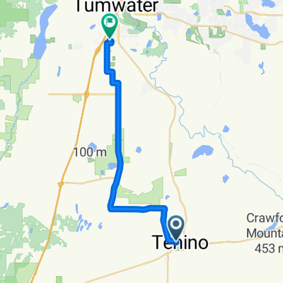
- Tenino, Washington, United States
A cycling route starting in Tenino, Washington, United States.
Overview
Millersylvania to Longview. This will mimic STP
created this 12 years ago
Route quality
Road
57.2 km
(54 %)
Quiet road
8.5 km
(8 %)
Paved
27.5 km
(26 %)
Asphalt
27.5 km
(26 %)
Undefined
78.4 km
(74 %)
Route highlights
Quality Inn! Night two and a swim pool to boot!
Continue with Bikemap
You would like to ride POOP Day Two or customize it for your own trip? Here is what you can do with this Bikemap route:
Free trial for 3 days, or one-time payment. More about Bikemap Premium.
Discover more Premium features.
Get Bikemap PremiumFrom our community
Open it in the app