

Tölz-Osterseen-Tölz
A cycling route starting in Wackersberg, Bavaria, Germany.
Overview
About this route
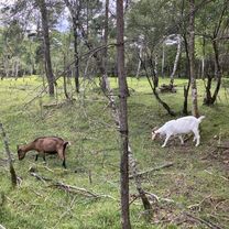
Beautiful landscapes and lovely cycling paths
- -:--
- Duration
- 74.4 km
- Distance
- 400 m
- Ascent
- 400 m
- Descent
- ---
- Avg. speed
- ---
- Max. altitude
Route quality
Waytypes & surfaces along the route
Waytypes
Quiet road
35 km
(47 %)
Track
14.9 km
(20 %)
Surfaces
Paved
58 km
(78 %)
Unpaved
11.9 km
(16 %)
Asphalt
52.8 km
(71 %)
Gravel
9.7 km
(13 %)
Continue with Bikemap
Use, edit, or download this cycling route
You would like to ride Tölz-Osterseen-Tölz or customize it for your own trip? Here is what you can do with this Bikemap route:
Free features
- Save this route as favorite or in collections
- Copy & plan your own version of this route
- Sync your route with Garmin or Wahoo
Premium features
Free trial for 3 days, or one-time payment. More about Bikemap Premium.
- Navigate this route on iOS & Android
- Export a GPX / KML file of this route
- Create your custom printout (try it for free)
- Download this route for offline navigation
Discover more Premium features.
Get Bikemap PremiumFrom our community
Other popular routes starting in Wackersberg
 7. Stallau-Murnau-43km-329Hm
- Distance
- 43.2 km
- Ascent
- 271 m
- Descent
- 352 m
- Location
- Wackersberg, Bavaria, Germany
 Wackersberg Bad Tölz
- Distance
- 23.2 km
- Ascent
- 358 m
- Descent
- 355 m
- Location
- Wackersberg, Bavaria, Germany
 Mit dem MTB um den Hochtannenkopf
- Distance
- 28.8 km
- Ascent
- 960 m
- Descent
- 961 m
- Location
- Wackersberg, Bavaria, Germany
 Tölz-Eschenlohe-Tölz
- Distance
- 88.1 km
- Ascent
- 503 m
- Descent
- 504 m
- Location
- Wackersberg, Bavaria, Germany
 Tölzer Runde
- Distance
- 80.5 km
- Ascent
- 1,127 m
- Descent
- 1,115 m
- Location
- Wackersberg, Bavaria, Germany
 Blomberg-Runde mit Trails bergab
- Distance
- 12.3 km
- Ascent
- 712 m
- Descent
- 699 m
- Location
- Wackersberg, Bavaria, Germany
 achensee lenggries
- Distance
- 46.5 km
- Ascent
- 681 m
- Descent
- 412 m
- Location
- Wackersberg, Bavaria, Germany
 Blombergrunde
- Distance
- 21.2 km
- Ascent
- 708 m
- Descent
- 707 m
- Location
- Wackersberg, Bavaria, Germany
Open it in the app