

some nice hills :)
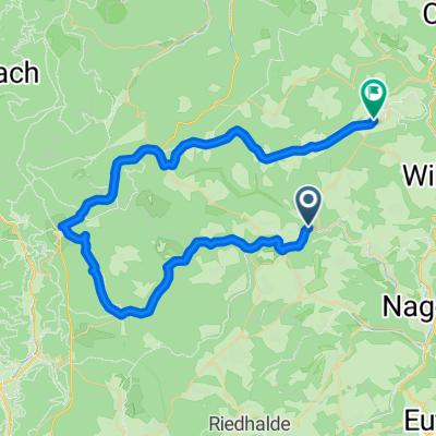
A cycling route starting in Altensteig, Baden-Württemberg, Germany.
Overview
About this route
a nice rout to train mountain and flat skills.
- -:--
- Duration
- 66.8 km
- Distance
- 852 m
- Ascent
- 852 m
- Descent
- ---
- Avg. speed
- ---
- Max. altitude
Route quality
Waytypes & surfaces along the route
Waytypes
Road
40.1 km
(60 %)
Busy road
23.8 km
(36 %)
Surfaces
Paved
47.8 km
(72 %)
Unpaved
0.3 km
(<1 %)
Asphalt
47.7 km
(71 %)
Gravel
0.3 km
(<1 %)
Continue with Bikemap
Use, edit, or download this cycling route
You would like to ride some nice hills :) or customize it for your own trip? Here is what you can do with this Bikemap route:
Free features
- Save this route as favorite or in collections
- Copy & plan your own version of this route
- Sync your route with Garmin or Wahoo
Premium features
Free trial for 3 days, or one-time payment. More about Bikemap Premium.
- Navigate this route on iOS & Android
- Export a GPX / KML file of this route
- Create your custom printout (try it for free)
- Download this route for offline navigation
Discover more Premium features.
Get Bikemap PremiumFrom our community
Other popular routes starting in Altensteig
 2019 Tag2 Besenfeld - Herrenberg
- Distance
- 29.6 km
- Ascent
- 320 m
- Descent
- 350 m
- Location
- Altensteig, Baden-Württemberg, Germany
 some nice hills :)
- Distance
- 66.8 km
- Ascent
- 852 m
- Descent
- 852 m
- Location
- Altensteig, Baden-Württemberg, Germany
 Altensteig - Enzklösterle - Altensteig
- Distance
- 48.5 km
- Ascent
- 726 m
- Descent
- 723 m
- Location
- Altensteig, Baden-Württemberg, Germany
 Von Überberg nach Berneck
- Distance
- 12 km
- Ascent
- 231 m
- Descent
- 239 m
- Location
- Altensteig, Baden-Württemberg, Germany
 Swartzwald rundtur 44 km
- Distance
- 43.7 km
- Ascent
- 915 m
- Descent
- 910 m
- Location
- Altensteig, Baden-Württemberg, Germany
 camping swartswald 33 km
- Distance
- 32.8 km
- Ascent
- 617 m
- Descent
- 608 m
- Location
- Altensteig, Baden-Württemberg, Germany
 150621 Sonntagstour
- Distance
- 49.8 km
- Ascent
- 489 m
- Descent
- 357 m
- Location
- Altensteig, Baden-Württemberg, Germany
 Zinsbachtal
- Distance
- 27.6 km
- Ascent
- 351 m
- Descent
- 343 m
- Location
- Altensteig, Baden-Württemberg, Germany
Open it in the app