

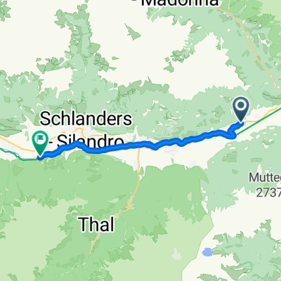
Ciardes - Ospedaletto
A cycling route starting in Castelbello, Trentino-Alto Adige, Italy.
Overview
About this route
approx. 13-hour bike ride from Ciardes (BZ) to Vicenza via the Valsugana
- -:--
- Duration
- 234.5 km
- Distance
- 1,847 m
- Ascent
- 2,458 m
- Descent
- ---
- Avg. speed
- ---
- Max. altitude
Route highlights
Points of interest along the route
Point of interest after 103.1 km
trenp
Continue with Bikemap
Use, edit, or download this cycling route
You would like to ride Ciardes - Ospedaletto or customize it for your own trip? Here is what you can do with this Bikemap route:
Free features
- Save this route as favorite or in collections
- Copy & plan your own version of this route
- Split it into stages to create a multi-day tour
- Sync your route with Garmin or Wahoo
Premium features
Free trial for 3 days, or one-time payment. More about Bikemap Premium.
- Navigate this route on iOS & Android
- Export a GPX / KML file of this route
- Create your custom printout (try it for free)
- Download this route for offline navigation
Discover more Premium features.
Get Bikemap PremiumFrom our community
Other popular routes starting in Castelbello
 Uphill Marzoner Alm 2
- Distance
- 11.9 km
- Ascent
- 1,099 m
- Descent
- 65 m
- Location
- Castelbello, Trentino-Alto Adige, Italy
 46.635, 10.921 nach 46.612, 10.729
- Distance
- 17.7 km
- Ascent
- 321 m
- Descent
- 79 m
- Location
- Castelbello, Trentino-Alto Adige, Italy
 in3nap
- Distance
- 107.4 km
- Ascent
- 2,202 m
- Descent
- 2,252 m
- Location
- Castelbello, Trentino-Alto Adige, Italy
 Tschars Tablander Alm
- Distance
- 13.9 km
- Ascent
- 1,260 m
- Descent
- 55 m
- Location
- Castelbello, Trentino-Alto Adige, Italy
 Uphill Tablander Alm
- Distance
- 13.5 km
- Ascent
- 1,218 m
- Descent
- 14 m
- Location
- Castelbello, Trentino-Alto Adige, Italy
 Ciardes - Ospedaletto
- Distance
- 234.5 km
- Ascent
- 1,847 m
- Descent
- 2,458 m
- Location
- Castelbello, Trentino-Alto Adige, Italy
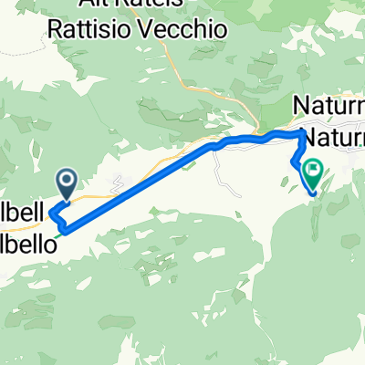 Eichgasse, Kastelbell-Tschars nach Rolweg, Naturns
- Distance
- 8.9 km
- Ascent
- 135 m
- Descent
- 47 m
- Location
- Castelbello, Trentino-Alto Adige, Italy
 Runde Müstair
- Distance
- 206.9 km
- Ascent
- 2,228 m
- Descent
- 2,218 m
- Location
- Castelbello, Trentino-Alto Adige, Italy
Open it in the app