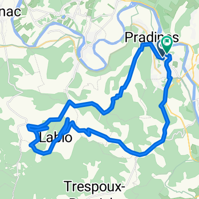
martial 25 juin 2013
A cycling route starting in Pradines, Occitanie, France.
Overview
About this route
beautiful ride with lovely climbs!
- -:--
- Duration
- 60.2 km
- Distance
- 592 m
- Ascent
- 592 m
- Descent
- ---
- Avg. speed
- ---
- Max. altitude
Route quality
Waytypes & surfaces along the route
Waytypes
Road
32.5 km
(54 %)
Quiet road
12 km
(20 %)
Surfaces
Paved
9 km
(15 %)
Unpaved
1.8 km
(3 %)
Asphalt
9 km
(15 %)
Gravel
1.8 km
(3 %)
Undefined
49.4 km
(82 %)
Continue with Bikemap
Use, edit, or download this cycling route
You would like to ride martial 25 juin 2013 or customize it for your own trip? Here is what you can do with this Bikemap route:
Free features
- Save this route as favorite or in collections
- Copy & plan your own version of this route
- Sync your route with Garmin or Wahoo
Premium features
Free trial for 3 days, or one-time payment. More about Bikemap Premium.
- Navigate this route on iOS & Android
- Export a GPX / KML file of this route
- Create your custom printout (try it for free)
- Download this route for offline navigation
Discover more Premium features.
Get Bikemap PremiumFrom our community
Other popular routes starting in Pradines
Cahors Lagardelles- Distance
- 56.2 km
- Ascent
- 512 m
- Descent
- 505 m
- Location
- Pradines, Occitanie, France
DOUELLE --- CAHORS --- DOUELLE- Distance
- 27.1 km
- Ascent
- 196 m
- Descent
- 196 m
- Location
- Pradines, Occitanie, France
martial 25 juin 2013- Distance
- 60.2 km
- Ascent
- 592 m
- Descent
- 592 m
- Location
- Pradines, Occitanie, France
De Rue Clément Ader à Rue Clément Ader- Distance
- 27.4 km
- Ascent
- 715 m
- Descent
- 715 m
- Location
- Pradines, Occitanie, France
Route de Mercuès, Cahors à Route de Mercuès, Cahors- Distance
- 10.1 km
- Ascent
- 137 m
- Descent
- 140 m
- Location
- Pradines, Occitanie, France
O Vers..... PUYCELCI 2019- Distance
- 125.7 km
- Ascent
- 1,646 m
- Descent
- 1,713 m
- Location
- Pradines, Occitanie, France
De Caillac à Route du Lac 208, Caillac- Distance
- 53 km
- Ascent
- 1,025 m
- Descent
- 1,023 m
- Location
- Pradines, Occitanie, France
Itinéraire reposant en Catus- Distance
- 13.9 km
- Ascent
- 499 m
- Descent
- 486 m
- Location
- Pradines, Occitanie, France
Open it in the app


