

Brühl - HD - KS - Brühl
A cycling route starting in Brühl, Baden-Wurttemberg, Germany.
Overview
About this route
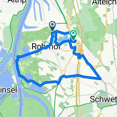
Starting from Brühl, it goes over Schwetzingen towards Heidelberg on solid bike paths. In Heidelberg, where it leaves the roads, there is a small steep pushing/carrying section. Once at the top, you can ride again (a short unpaved section). Then it continues towards Königstuhl HD on gravel trails. The section just before the KS is a bit steep. From Königstuhl you go past Kohlhof to the three oaks, partly on road and partly on forest paths. From the three oaks, it continues on gravel paths past the Waidhaus and the Hirschplatt hut towards Emmertsgrund. Upon reaching the power poles, you turn left onto an unpaved trail. Now follow the forest paths, passing the memorial through the vineyards towards Leimen. Once down, you only have to take bike paths back towards Brühl, past Schwetzingen.
- -:--
- Duration
- 50.3 km
- Distance
- 466 m
- Ascent
- 466 m
- Descent
- ---
- Avg. speed
- ---
- Max. altitude
Route quality
Waytypes & surfaces along the route
Waytypes
Track
28.2 km
(56 %)
Quiet road
6.5 km
(13 %)
Surfaces
Paved
33.2 km
(66 %)
Unpaved
14.6 km
(29 %)
Asphalt
32.2 km
(64 %)
Gravel
11.1 km
(22 %)
Continue with Bikemap
Use, edit, or download this cycling route
You would like to ride Brühl - HD - KS - Brühl or customize it for your own trip? Here is what you can do with this Bikemap route:
Free features
- Save this route as favorite or in collections
- Copy & plan your own version of this route
- Sync your route with Garmin or Wahoo
Premium features
Free trial for 3 days, or one-time payment. More about Bikemap Premium.
- Navigate this route on iOS & Android
- Export a GPX / KML file of this route
- Create your custom printout (try it for free)
- Download this route for offline navigation
Discover more Premium features.
Get Bikemap PremiumFrom our community
Other popular routes starting in Brühl
 Brühl - HD - KS - Brühl
- Distance
- 50.3 km
- Ascent
- 466 m
- Descent
- 466 m
- Location
- Brühl, Baden-Wurttemberg, Germany
 Brühl, Ketsch, Antwerpen
- Distance
- 17.2 km
- Ascent
- 7 m
- Descent
- 4 m
- Location
- Brühl, Baden-Wurttemberg, Germany
 Brühl (RohrhoferStr) - Pfingstberg (Am Waldrand)
- Distance
- 7.3 km
- Ascent
- 19 m
- Descent
- 11 m
- Location
- Brühl, Baden-Wurttemberg, Germany
 Brühl - Schwetzinger Wald - 25km
- Distance
- 21.6 km
- Ascent
- 43 m
- Descent
- 44 m
- Location
- Brühl, Baden-Wurttemberg, Germany
 Johanneshof
- Distance
- 8.4 km
- Ascent
- 15 m
- Descent
- 18 m
- Location
- Brühl, Baden-Wurttemberg, Germany
 Rheinau - Speyer - Rheinau
- Distance
- 33.6 km
- Ascent
- 57 m
- Descent
- 58 m
- Location
- Brühl, Baden-Wurttemberg, Germany
 Brühl-Seckenheim
- Distance
- 14.7 km
- Ascent
- 43 m
- Descent
- 43 m
- Location
- Brühl, Baden-Wurttemberg, Germany
 st.leon-rot_weisses Häusel LU
- Distance
- 43 km
- Ascent
- 61 m
- Descent
- 59 m
- Location
- Brühl, Baden-Wurttemberg, Germany
Open it in the app