
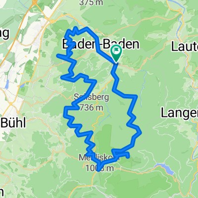
Feierabend Trainingsrunde
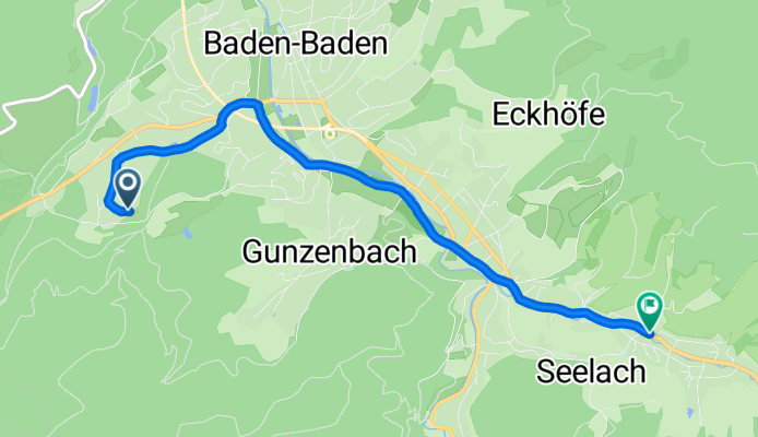
A cycling route starting in Baden-Baden, Baden-Wurttemberg, Germany.
Overview
About this route
The route starts at the parking lot by the SWR Campus. From there, it goes along the Lichtentaler Allee through Lichtental towards Oberbeuren. There, you must turn right before the Hotel Waldhorn. From this point on, it's uphill on field, forest paths, and asphalt past the gasthaus Scherrhof to the 'Rote Lach' (lower right tip of the circle). From there, it goes downhill along a forest path to Gaisbach. From there, continue downhill through Lichtental and then back up the hill to the SWR parking lot.
I rode the tour without any problems on my cyclocross bike.
(cloned from route 279189)
- -:--
- Duration
- 4.8 km
- Distance
- 19 m
- Ascent
- 55 m
- Descent
- ---
- Avg. speed
- ---
- Max. altitude

Route quality
Waytypes & surfaces along the route
Waytypes
Quiet road
2 km
(41 %)
Pedestrian area
1.3 km
(27 %)
Surfaces
Paved
2.8 km
(58 %)
Unpaved
0.5 km
(11 %)
Asphalt
2.8 km
(58 %)
Gravel
0.4 km
(9 %)
Continue with Bikemap
Use, edit, or download this cycling route
You would like to ride Feierabend Trainingsrunde or customize it for your own trip? Here is what you can do with this Bikemap route:
Free features
- Save this route as favorite or in collections
- Copy & plan your own version of this route
- Sync your route with Garmin or Wahoo
Premium features
Free trial for 3 days, or one-time payment. More about Bikemap Premium.
- Navigate this route on iOS & Android
- Export a GPX / KML file of this route
- Create your custom printout (try it for free)
- Download this route for offline navigation
Discover more Premium features.
Get Bikemap PremiumFrom our community
Other popular routes starting in Baden-Baden
 De Hauptstraße 74, Baden-Baden à Hauptstraße 74, Baden-Baden
- Distance
- 59.4 km
- Ascent
- 1,510 m
- Descent
- 1,504 m
- Location
- Baden-Baden, Baden-Wurttemberg, Germany
 От B500 19, Baden-Baden до Industriestraße 18A, Sinzheim
- Distance
- 123 km
- Ascent
- 342 m
- Descent
- 417 m
- Location
- Baden-Baden, Baden-Wurttemberg, Germany
 От Geroldsauer Straße 21, Baden-Baden до Geroldsauer Straße 19, Baden-Baden
- Distance
- 111 km
- Ascent
- 227 m
- Descent
- 282 m
- Location
- Baden-Baden, Baden-Wurttemberg, Germany
 Bad Gasgenau Bad Herrenalb 50 1040hm
- Distance
- 48.2 km
- Ascent
- 1,030 m
- Descent
- 1,048 m
- Location
- Baden-Baden, Baden-Wurttemberg, Germany
 Feierabend Trainingsrunde
- Distance
- 25.7 km
- Ascent
- 669 m
- Descent
- 671 m
- Location
- Baden-Baden, Baden-Wurttemberg, Germany
 Lange Radrunde um Baden-Baden über Plättig und Rote Lache
- Distance
- 46.6 km
- Ascent
- 845 m
- Descent
- 852 m
- Location
- Baden-Baden, Baden-Wurttemberg, Germany
 Baden-Baden Schwarzwald Tour
- Distance
- 106.3 km
- Ascent
- 1,741 m
- Descent
- 1,741 m
- Location
- Baden-Baden, Baden-Wurttemberg, Germany
 Ooswinkler's Hausstrecke
- Distance
- 32.6 km
- Ascent
- 1,308 m
- Descent
- 1,190 m
- Location
- Baden-Baden, Baden-Wurttemberg, Germany
Open it in the app