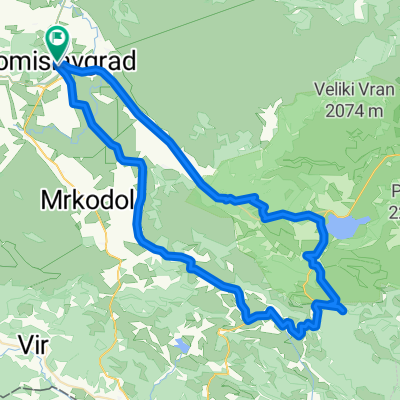
Farma Smiljanić-Kukavičje jezero
- 56.7 km
- 408 m
- 411 m
- Tomislavgrad, Federation of Bosnia and Herzegovina, Bosnia and Herzegovina
A cycling route starting in Tomislavgrad, Federation of Bosnia and Herzegovina, Bosnia and Herzegovina.
Overview
Start from Privale, viewpoint before descending to Buško lake, crossing the bridge in Prisoje, Golinjevo, Miši, in Podhumu towards Podgradina, then over the dam to café San Antonio in Kazagincu, return but in Grabovica turn off and visit Eco village, a little off-road through Dobrić back to the starting position - viewpoint at Privale.
created this 12 years ago
Continue with Bikemap
You would like to ride Oko Buškog jezera 1.0 or customize it for your own trip? Here is what you can do with this Bikemap route:
Free trial for 3 days, or one-time payment. More about Bikemap Premium.
Discover more Premium features.
Get Bikemap PremiumFrom our community
Open it in the app