

Sackenbach - Biergarten Himmelstadt
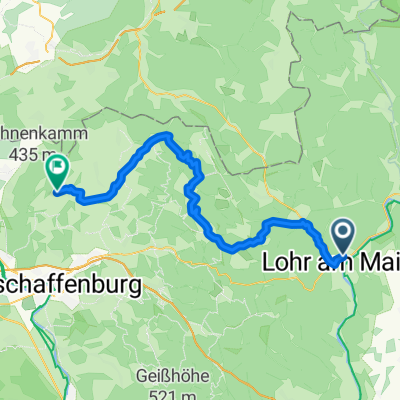
A cycling route starting in Lohr a. Main, Bavaria, Germany.
Overview
About this route
Sackenbach - Karlstadt Karlsburg - Biergarten Himmelstadt - Edelweiß - Sohlhöhe - Sackenbach
- -:--
- Duration
- 68.5 km
- Distance
- 871 m
- Ascent
- 871 m
- Descent
- ---
- Avg. speed
- ---
- Max. altitude
Route quality
Waytypes & surfaces along the route
Waytypes
Track
29.3 km
(43 %)
Path
13.2 km
(19 %)
Surfaces
Paved
23.2 km
(34 %)
Unpaved
26.2 km
(38 %)
Asphalt
16.5 km
(24 %)
Gravel
12 km
(18 %)
Route highlights
Points of interest along the route

Point of interest after 21.2 km
Karlstadt - Burg Karlsburg http://de.wikipedia.org/wiki/Karlsburg_%28Burg%29

Point of interest after 27 km
Biergarten Downtown
Point of interest after 39 km
Karlstadt - Edelweiß
Point of interest after 64.2 km
Sohlhöhe
Continue with Bikemap
Use, edit, or download this cycling route
You would like to ride Sackenbach - Biergarten Himmelstadt or customize it for your own trip? Here is what you can do with this Bikemap route:
Free features
- Save this route as favorite or in collections
- Copy & plan your own version of this route
- Sync your route with Garmin or Wahoo
Premium features
Free trial for 3 days, or one-time payment. More about Bikemap Premium.
- Navigate this route on iOS & Android
- Export a GPX / KML file of this route
- Create your custom printout (try it for free)
- Download this route for offline navigation
Discover more Premium features.
Get Bikemap PremiumFrom our community
Other popular routes starting in Lohr a. Main
 Ausfahrt durch Lohr am Main
- Distance
- 27.1 km
- Ascent
- 364 m
- Descent
- 367 m
- Location
- Lohr a. Main, Bavaria, Germany
 Von Lohr ins Sinntal
- Distance
- 47.4 km
- Ascent
- 77 m
- Descent
- 77 m
- Location
- Lohr a. Main, Bavaria, Germany
 1ter Tag Lohr Mömbris
- Distance
- 56.5 km
- Ascent
- 542 m
- Descent
- 483 m
- Location
- Lohr a. Main, Bavaria, Germany
 Lohr - Kreuzberg
- Distance
- 83.6 km
- Ascent
- 1,518 m
- Descent
- 865 m
- Location
- Lohr a. Main, Bavaria, Germany
 Mainradweg Lohr am Main - Miltenberg
- Distance
- 78.9 km
- Ascent
- 0 m
- Descent
- 0 m
- Location
- Lohr a. Main, Bavaria, Germany
 Lohr-Maintal-Platte
- Distance
- 33.4 km
- Ascent
- 345 m
- Descent
- 246 m
- Location
- Lohr a. Main, Bavaria, Germany
 Lohr - Forsthäuser Tour - Hafenlohr - Lohr
- Distance
- 65.9 km
- Ascent
- 842 m
- Descent
- 841 m
- Location
- Lohr a. Main, Bavaria, Germany
 LohramMain
- Distance
- 127.3 km
- Ascent
- 1,717 m
- Descent
- 1,732 m
- Location
- Lohr a. Main, Bavaria, Germany
Open it in the app