

Tromeja trojček
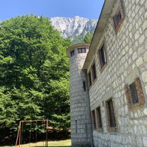
A cycling route starting in Bovec, Občina Bovec, Slovenia.
Overview
About this route
Iz Bovca v Bovec čez Predil, Podkoren in Vršič.
- -:--
- Duration
- 107.8 km
- Distance
- 2,014 m
- Ascent
- 2,014 m
- Descent
- ---
- Avg. speed
- ---
- Max. altitude
Continue with Bikemap
Use, edit, or download this cycling route
You would like to ride Tromeja trojček or customize it for your own trip? Here is what you can do with this Bikemap route:
Free features
- Save this route as favorite or in collections
- Copy & plan your own version of this route
- Split it into stages to create a multi-day tour
- Sync your route with Garmin or Wahoo
Premium features
Free trial for 3 days, or one-time payment. More about Bikemap Premium.
- Navigate this route on iOS & Android
- Export a GPX / KML file of this route
- Create your custom printout (try it for free)
- Download this route for offline navigation
Discover more Premium features.
Get Bikemap PremiumFrom our community
Other popular routes starting in Bovec
 Možnica
- Distance
- 3.2 km
- Ascent
- 324 m
- Descent
- 101 m
- Location
- Bovec, Občina Bovec, Slovenia
 Bovec zahodna pot
- Distance
- 18.3 km
- Ascent
- 338 m
- Descent
- 334 m
- Location
- Bovec, Občina Bovec, Slovenia
 Bovec - Socca Tal - Bovec
- Distance
- 38.6 km
- Ascent
- 1,194 m
- Descent
- 1,195 m
- Location
- Bovec, Občina Bovec, Slovenia
 Slovinským Krasem k Jadranu - 2. den
- Distance
- 84.4 km
- Ascent
- 1,030 m
- Descent
- 1,411 m
- Location
- Bovec, Občina Bovec, Slovenia
 Bovec Možnica
- Distance
- 13.9 km
- Ascent
- 701 m
- Descent
- 307 m
- Location
- Bovec, Občina Bovec, Slovenia
 Bovec, Vrsic, Tarvisio, Predil, Bovec
- Distance
- 95.4 km
- Ascent
- 1,704 m
- Descent
- 1,704 m
- Location
- Bovec, Občina Bovec, Slovenia
 Julijska tura: Na Mangart
- Distance
- 11.6 km
- Ascent
- 1,029 m
- Descent
- 146 m
- Location
- Bovec, Občina Bovec, Slovenia
 Bovec
Bovec- Distance
- 114.7 km
- Ascent
- 3,091 m
- Descent
- 3,089 m
- Location
- Bovec, Občina Bovec, Slovenia
Open it in the app