

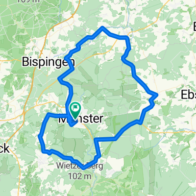
Volksrafahren-Munster-2013
A cycling route starting in Munster, Lower Saxony, Germany.
Overview
About this route
Volksrafahren-Munster-Nord 55Km 2013
- -:--
- Duration
- 54.4 km
- Distance
- 136 m
- Ascent
- 136 m
- Descent
- ---
- Avg. speed
- ---
- Max. altitude
Continue with Bikemap
Use, edit, or download this cycling route
You would like to ride Volksrafahren-Munster-2013 or customize it for your own trip? Here is what you can do with this Bikemap route:
Free features
- Save this route as favorite or in collections
- Copy & plan your own version of this route
- Sync your route with Garmin or Wahoo
Premium features
Free trial for 3 days, or one-time payment. More about Bikemap Premium.
- Navigate this route on iOS & Android
- Export a GPX / KML file of this route
- Create your custom printout (try it for free)
- Download this route for offline navigation
Discover more Premium features.
Get Bikemap PremiumFrom our community
Other popular routes starting in Munster
 04_Munster - Bahnhof Lüneburg
- Distance
- 54.6 km
- Ascent
- 336 m
- Descent
- 395 m
- Location
- Munster, Lower Saxony, Germany
 Munster-Breloh endlang des Örtzewiesenweges
- Distance
- 29.5 km
- Ascent
- 98 m
- Descent
- 98 m
- Location
- Munster, Lower Saxony, Germany
 03_Müden (Örtze): Was mag sich unter den Hügeln verbergen?
- Distance
- 75 km
- Ascent
- 376 m
- Descent
- 376 m
- Location
- Munster, Lower Saxony, Germany
 Munster-Runde
- Distance
- 91.6 km
- Ascent
- 232 m
- Descent
- 232 m
- Location
- Munster, Lower Saxony, Germany
 Radwandern Heideregion Nr.23
- Distance
- 46.5 km
- Ascent
- 120 m
- Descent
- 119 m
- Location
- Munster, Lower Saxony, Germany
 Volksrafahren-Munster-2013
- Distance
- 54.4 km
- Ascent
- 136 m
- Descent
- 136 m
- Location
- Munster, Lower Saxony, Germany
 Munster-Celle Rundfahrt
- Distance
- 143.8 km
- Ascent
- 287 m
- Descent
- 295 m
- Location
- Munster, Lower Saxony, Germany
 StO Marschstrecke - Start: Hagebau
- Distance
- 18 km
- Ascent
- 50 m
- Descent
- 51 m
- Location
- Munster, Lower Saxony, Germany
Open it in the app