

Juhöhe - Hüttelfeld - Weinheim - Lampenhain - Siedelsbrunn
A cycling route starting in Rimbach, Hesse, Germany.
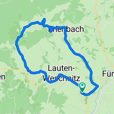
Overview
About this route
Die Route geht von Hemsbach bis Schriesheim über die B3. An Werktagen vermeiden, da zu viel Verkehr. Nach Altenbach bis Lampenhain sind Steigunen von 8% zu überwinden. In Lampenhain geht es dann mit 9% Abwärts.
- -:--
- Duration
- 79.6 km
- Distance
- 778 m
- Ascent
- 780 m
- Descent
- ---
- Avg. speed
- ---
- Max. altitude

Route quality
Waytypes & surfaces along the route
Waytypes
Busy road
54.2 km
(68 %)
Road
10.2 km
(13 %)
Surfaces
Paved
76.7 km
(96 %)
Unpaved
0.1 km
(<1 %)
Asphalt
71.3 km
(90 %)
Paving stones
4.7 km
(6 %)
Continue with Bikemap
Use, edit, or download this cycling route
You would like to ride Juhöhe - Hüttelfeld - Weinheim - Lampenhain - Siedelsbrunn or customize it for your own trip? Here is what you can do with this Bikemap route:
Free features
- Save this route as favorite or in collections
- Copy & plan your own version of this route
- Sync your route with Garmin or Wahoo
Premium features
Free trial for 3 days, or one-time payment. More about Bikemap Premium.
- Navigate this route on iOS & Android
- Export a GPX / KML file of this route
- Create your custom printout (try it for free)
- Download this route for offline navigation
Discover more Premium features.
Get Bikemap PremiumFrom our community
Other popular routes starting in Rimbach
 Rennstrecke - Wegscheide - Gumpener Kreuz
- Distance
- 45.6 km
- Ascent
- 473 m
- Descent
- 473 m
- Location
- Rimbach, Hesse, Germany
 Fürth - Winterkasten - Fr.-Crumbach - Ostern
- Distance
- 44.4 km
- Ascent
- 570 m
- Descent
- 570 m
- Location
- Rimbach, Hesse, Germany
 Seeheim - Neunkirchen
- Distance
- 59.9 km
- Ascent
- 688 m
- Descent
- 688 m
- Location
- Rimbach, Hesse, Germany
 Rundkurs
- Distance
- 13.6 km
- Ascent
- 224 m
- Descent
- 222 m
- Location
- Rimbach, Hesse, Germany
 Gersprenz - Brombachtal - Otzberg
- Distance
- 65.9 km
- Ascent
- 532 m
- Descent
- 532 m
- Location
- Rimbach, Hesse, Germany
 Überwaldrunde
- Distance
- 49.5 km
- Ascent
- 1,171 m
- Descent
- 1,171 m
- Location
- Rimbach, Hesse, Germany
 Tromm-Runde
- Distance
- 39.1 km
- Ascent
- 711 m
- Descent
- 711 m
- Location
- Rimbach, Hesse, Germany
 Juhöhe - Hüttelfeld - Weinheim - Lampenhain - Siedelsbrunn
- Distance
- 79.6 km
- Ascent
- 778 m
- Descent
- 780 m
- Location
- Rimbach, Hesse, Germany
Open it in the app