

Baltic Sea 2009 - stage 9
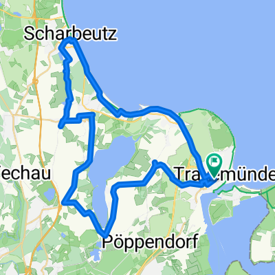
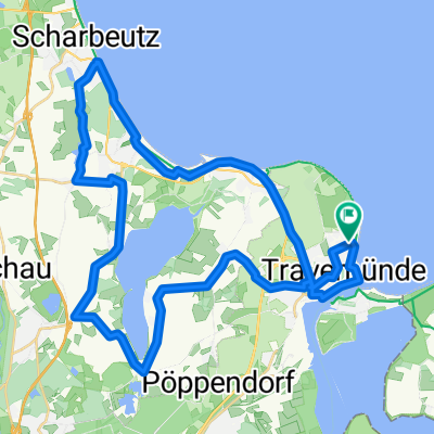
A cycling route starting in Travemünde, Schleswig-Holstein, Germany.
Overview
About this route
Travemünde .. Wismar, i.W. auf dem Ostseeküsten-Radweg (D-Route 2). Viel naturbelassene Steilküste, teils mit spürbaren Steigungen. Wismar ist Highlight.
- -:--
- Duration
- 68.3 km
- Distance
- 214 m
- Ascent
- 210 m
- Descent
- ---
- Avg. speed
- 38 m
- Max. altitude

Route quality
Waytypes & surfaces along the route
Waytypes
Path
21.2 km
(31 %)
Quiet road
17.8 km
(26 %)
Surfaces
Paved
36.9 km
(54 %)
Unpaved
13 km
(19 %)
Asphalt
35.5 km
(52 %)
Gravel
5.5 km
(8 %)
Route highlights
Points of interest along the route
Point of interest after 6.2 km
Wegweiser fehlen bzw. führen ins Hinterland - besser diesen Punkt anpeilen + ab da direkt entlang der Küste
Continue with Bikemap
Use, edit, or download this cycling route
You would like to ride Baltic Sea 2009 - stage 9 or customize it for your own trip? Here is what you can do with this Bikemap route:
Free features
- Save this route as favorite or in collections
- Copy & plan your own version of this route
- Sync your route with Garmin or Wahoo
Premium features
Free trial for 3 days, or one-time payment. More about Bikemap Premium.
- Navigate this route on iOS & Android
- Export a GPX / KML file of this route
- Create your custom printout (try it for free)
- Download this route for offline navigation
Discover more Premium features.
Get Bikemap PremiumFrom our community
Other popular routes starting in Travemünde
 Travemünde-Lübeck-Travemünde
- Distance
- 36 km
- Ascent
- 341 m
- Descent
- 340 m
- Location
- Travemünde, Schleswig-Holstein, Germany
 Travemünde - Grömiz
- Distance
- 41.9 km
- Ascent
- 181 m
- Descent
- 160 m
- Location
- Travemünde, Schleswig-Holstein, Germany
 Ostseeküste 6 Tage
- Distance
- 407.4 km
- Ascent
- 402 m
- Descent
- 390 m
- Location
- Travemünde, Schleswig-Holstein, Germany
 Travemünde- Hemmelsdorfer See- Scharbeutz-Travemünde
- Distance
- 37.6 km
- Ascent
- 171 m
- Descent
- 171 m
- Location
- Travemünde, Schleswig-Holstein, Germany
 Lembkestraße, Lübeck nach Lembkestraße, Lübeck
- Distance
- 39.9 km
- Ascent
- 207 m
- Descent
- 198 m
- Location
- Travemünde, Schleswig-Holstein, Germany
 Lübeck hin und zurück.
- Distance
- 28.8 km
- Ascent
- 218 m
- Descent
- 210 m
- Location
- Travemünde, Schleswig-Holstein, Germany
 Vorderreihe 51A, Lübeck nach Willy-Brandt-Allee 6, Lübeck
- Distance
- 22.2 km
- Ascent
- 155 m
- Descent
- 163 m
- Location
- Travemünde, Schleswig-Holstein, Germany
 Dag1TRGMJ2018
- Distance
- 162.3 km
- Ascent
- 224 m
- Descent
- 189 m
- Location
- Travemünde, Schleswig-Holstein, Germany
Open it in the app