

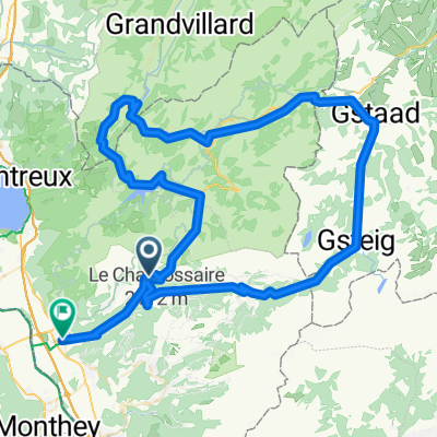
Col des Mosses - Les Mossettes - Rougemont - Gstaad - Zweisimmen
A cycling route starting in Leysin, Canton of Vaud, Switzerland.
Overview
About this route
3 day tour Starting at Aigle , finish at Frutigen. National Mountain Bike route No. 1 (Day 2)Col des Mosses - Les Mossettes - Chateau-d-Oex - La Laitemaire - Rougemont - Saanen - Gstaad - Saannenmoser - Zweisimmen63km, 1371 m , Trip time 5.32h
- -:--
- Duration
- 58.9 km
- Distance
- 1,404 m
- Ascent
- 1,903 m
- Descent
- ---
- Avg. speed
- ---
- Max. altitude

Continue with Bikemap
Use, edit, or download this cycling route
You would like to ride Col des Mosses - Les Mossettes - Rougemont - Gstaad - Zweisimmen or customize it for your own trip? Here is what you can do with this Bikemap route:
Free features
- Save this route as favorite or in collections
- Copy & plan your own version of this route
- Sync your route with Garmin or Wahoo
Premium features
Free trial for 3 days, or one-time payment. More about Bikemap Premium.
- Navigate this route on iOS & Android
- Export a GPX / KML file of this route
- Create your custom printout (try it for free)
- Download this route for offline navigation
Discover more Premium features.
Get Bikemap PremiumFrom our community
Other popular routes starting in Leysin
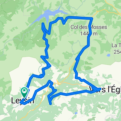
 Leysin 25 May
- Distance
- 97.7 km
- Ascent
- 2,395 m
- Descent
- 2,409 m
- Location
- Leysin, Canton of Vaud, Switzerland
 Col des Mosses - Les Mossettes - Rougemont - Gstaad - Zweisimmen
- Distance
- 58.9 km
- Ascent
- 1,404 m
- Descent
- 1,903 m
- Location
- Leysin, Canton of Vaud, Switzerland
 Pierre du Moëllé - Isenau
- Distance
- 100.9 km
- Ascent
- 1,982 m
- Descent
- 1,978 m
- Location
- Leysin, Canton of Vaud, Switzerland
 Day 3 Leg 2 Col du mosses to Villar (lunch)
- Distance
- 31.1 km
- Ascent
- 744 m
- Descent
- 929 m
- Location
- Leysin, Canton of Vaud, Switzerland
 Sépey-Pillon-Montbovon-Hongrin-Mosses-Aigle
- Distance
- 101 km
- Ascent
- 1,344 m
- Descent
- 1,923 m
- Location
- Leysin, Canton of Vaud, Switzerland
 Leysin-L'Ortier
- Distance
- 14.4 km
- Ascent
- 511 m
- Descent
- 517 m
- Location
- Leysin, Canton of Vaud, Switzerland
 Avenue Rollier 41, Leysin to Avenue Rollier 28, Leysin
- Distance
- 21 km
- Ascent
- 721 m
- Descent
- 721 m
- Location
- Leysin, Canton of Vaud, Switzerland
 aaaaa
aaaaa- Distance
- 46.3 km
- Ascent
- 1,371 m
- Descent
- 1,372 m
- Location
- Leysin, Canton of Vaud, Switzerland
Open it in the app