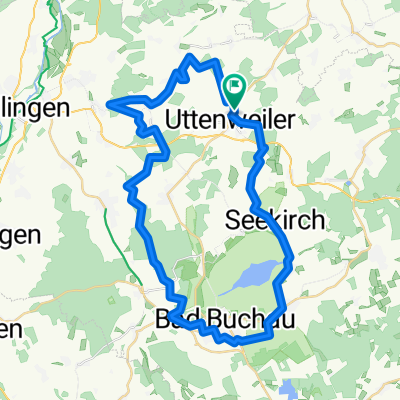
20130702 Bussen Federsee
A cycling route starting in Uttenweiler, Baden-Wurttemberg, Germany.
Overview
About this route
Over the Bussen (Singletrail), around the Federsee.
- -:--
- Duration
- 45.7 km
- Distance
- 336 m
- Ascent
- 336 m
- Descent
- ---
- Avg. speed
- ---
- Max. altitude
Route quality
Waytypes & surfaces along the route
Waytypes
Track
26.1 km
(57 %)
Quiet road
11.4 km
(25 %)
Surfaces
Paved
22.9 km
(50 %)
Unpaved
19.7 km
(43 %)
Asphalt
21.5 km
(47 %)
Gravel
11 km
(24 %)
Continue with Bikemap
Use, edit, or download this cycling route
You would like to ride 20130702 Bussen Federsee or customize it for your own trip? Here is what you can do with this Bikemap route:
Free features
- Save this route as favorite or in collections
- Copy & plan your own version of this route
- Sync your route with Garmin or Wahoo
Premium features
Free trial for 3 days, or one-time payment. More about Bikemap Premium.
- Navigate this route on iOS & Android
- Export a GPX / KML file of this route
- Create your custom printout (try it for free)
- Download this route for offline navigation
Discover more Premium features.
Get Bikemap PremiumFrom our community
Other popular routes starting in Uttenweiler
- ..durch die Wälder
- Distance
- 49.8 km
- Ascent
- 423 m
- Descent
- 421 m
- Location
- Uttenweiler, Baden-Wurttemberg, Germany
- "Blinder See" Runde
- Distance
- 48.5 km
- Ascent
- 223 m
- Descent
- 226 m
- Location
- Uttenweiler, Baden-Wurttemberg, Germany
- Burren-Runde - 20130528
- Distance
- 32.1 km
- Ascent
- 357 m
- Descent
- 351 m
- Location
- Uttenweiler, Baden-Wurttemberg, Germany
- über Schupfenberg und Bussen
- Distance
- 31.9 km
- Ascent
- 465 m
- Descent
- 465 m
- Location
- Uttenweiler, Baden-Wurttemberg, Germany
- Norden
- Distance
- 37.5 km
- Ascent
- 335 m
- Descent
- 335 m
- Location
- Uttenweiler, Baden-Wurttemberg, Germany
- "Blinder See" Runde
- Distance
- 66.2 km
- Ascent
- 303 m
- Descent
- 266 m
- Location
- Uttenweiler, Baden-Wurttemberg, Germany
- von Uttenweiler nach Kirchberg/Iller
- Distance
- 53.1 km
- Ascent
- 333 m
- Descent
- 340 m
- Location
- Uttenweiler, Baden-Wurttemberg, Germany
- Alptour
- Distance
- 63.4 km
- Ascent
- 562 m
- Descent
- 557 m
- Location
- Uttenweiler, Baden-Wurttemberg, Germany
Open it in the app