

8 peaks
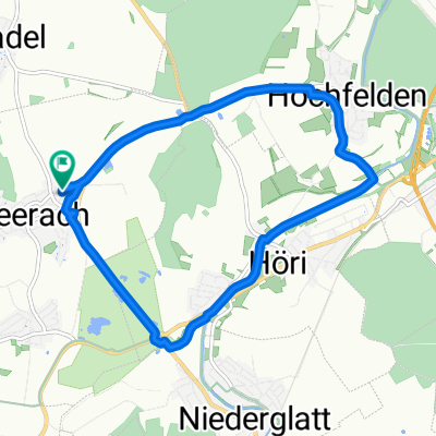
A cycling route starting in Neerach, Canton of Zurich, Switzerland.
Overview
About this route
coole Runde im ZH Unterland, einige Hm
- -:--
- Duration
- 83.6 km
- Distance
- 1,286 m
- Ascent
- 1,288 m
- Descent
- ---
- Avg. speed
- ---
- Max. altitude

Route quality
Waytypes & surfaces along the route
Waytypes
Road
31.8 km
(38 %)
Quiet road
18.4 km
(22 %)
Surfaces
Paved
75.3 km
(90 %)
Asphalt
73.6 km
(88 %)
Paved (undefined)
1.7 km
(2 %)
Undefined
8.4 km
(10 %)
Continue with Bikemap
Use, edit, or download this cycling route
You would like to ride 8 peaks or customize it for your own trip? Here is what you can do with this Bikemap route:
Free features
- Save this route as favorite or in collections
- Copy & plan your own version of this route
- Split it into stages to create a multi-day tour
- Sync your route with Garmin or Wahoo
Premium features
Free trial for 3 days, or one-time payment. More about Bikemap Premium.
- Navigate this route on iOS & Android
- Export a GPX / KML file of this route
- Create your custom printout (try it for free)
- Download this route for offline navigation
Discover more Premium features.
Get Bikemap PremiumFrom our community
Other popular routes starting in Neerach
 Regensberg und Flughafenrunde mit Hügel II
- Distance
- 54.7 km
- Ascent
- 611 m
- Descent
- 642 m
- Location
- Neerach, Canton of Zurich, Switzerland
 Neerach-Rorbas-Winterthur-Pfäffikon-Greifensee
- Distance
- 82.2 km
- Ascent
- 492 m
- Descent
- 492 m
- Location
- Neerach, Canton of Zurich, Switzerland
 Lange Ausfahrt durch Neerach
- Distance
- 31.1 km
- Ascent
- 85 m
- Descent
- 85 m
- Location
- Neerach, Canton of Zurich, Switzerland
 Eglisau 1
- Distance
- 34.2 km
- Ascent
- 329 m
- Descent
- 328 m
- Location
- Neerach, Canton of Zurich, Switzerland
 Ämtlertour plus Albis
- Distance
- 102.9 km
- Ascent
- 889 m
- Descent
- 884 m
- Location
- Neerach, Canton of Zurich, Switzerland
 Dürstelene - Sterneberg - Hulftegg - Kyburg
- Distance
- 136 km
- Ascent
- 1,229 m
- Descent
- 1,229 m
- Location
- Neerach, Canton of Zurich, Switzerland
 Sonntag Morgen Runde
- Distance
- 9.9 km
- Ascent
- 57 m
- Descent
- 60 m
- Location
- Neerach, Canton of Zurich, Switzerland
 MR Bachsertal Corona Route 21. 5. 2020
- Distance
- 9.9 km
- Ascent
- 255 m
- Descent
- 265 m
- Location
- Neerach, Canton of Zurich, Switzerland
Open it in the app