Pfannestiel tour ZHsee
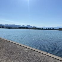
A cycling route starting in Wetzikon / Kempten, Canton of Zurich, Switzerland.
Overview
About this route
Pfannenstiel Rappi-Meilen-Greifensee
- -:--
- Duration
- 86.5 km
- Distance
- 546 m
- Ascent
- 540 m
- Descent
- ---
- Avg. speed
- ---
- Max. altitude
Route quality
Waytypes & surfaces along the route
Waytypes
Quiet road
28.3 km
(33 %)
Path
20.3 km
(23 %)
Surfaces
Paved
77.9 km
(90 %)
Unpaved
0.3 km
(<1 %)
Asphalt
76.2 km
(88 %)
Paved (undefined)
1.3 km
(2 %)
Continue with Bikemap
Use, edit, or download this cycling route
You would like to ride Pfannestiel tour ZHsee or customize it for your own trip? Here is what you can do with this Bikemap route:
Free features
- Save this route as favorite or in collections
- Copy & plan your own version of this route
- Split it into stages to create a multi-day tour
- Sync your route with Garmin or Wahoo
Premium features
Free trial for 3 days, or one-time payment. More about Bikemap Premium.
- Navigate this route on iOS & Android
- Export a GPX / KML file of this route
- Create your custom printout (try it for free)
- Download this route for offline navigation
Discover more Premium features.
Get Bikemap PremiumFrom our community
Other popular routes starting in Wetzikon / Kempten
- Kaba MTB Ride Puls III
- Distance
- 48.6 km
- Ascent
- 1,011 m
- Descent
- 1,011 m
- Location
- Wetzikon / Kempten, Canton of Zurich, Switzerland
- Kaba MTB Ride 2010 Puls I
- Distance
- 32.3 km
- Ascent
- 539 m
- Descent
- 539 m
- Location
- Wetzikon / Kempten, Canton of Zurich, Switzerland
- Pfannestiel tour ZHsee
- Distance
- 86.5 km
- Ascent
- 546 m
- Descent
- 540 m
- Location
- Wetzikon / Kempten, Canton of Zurich, Switzerland
- Wetzikon - Stettbach - Opfikerpark
- Distance
- 24.8 km
- Ascent
- 58 m
- Descent
- 197 m
- Location
- Wetzikon / Kempten, Canton of Zurich, Switzerland
- Kaba MTB Ride 2010 Puls II
- Distance
- 34.8 km
- Ascent
- 674 m
- Descent
- 674 m
- Location
- Wetzikon / Kempten, Canton of Zurich, Switzerland
- Rundtour Greifensee ab Kempten
- Distance
- 49.4 km
- Ascent
- 258 m
- Descent
- 258 m
- Location
- Wetzikon / Kempten, Canton of Zurich, Switzerland
- Elgger Runde
- Distance
- 59.6 km
- Ascent
- 838 m
- Descent
- 751 m
- Location
- Wetzikon / Kempten, Canton of Zurich, Switzerland
- Kastellstrasse 10, Wetzikon ZH nach Bachtelstrasse 25, Winterthur
- Distance
- 25.8 km
- Ascent
- 612 m
- Descent
- 696 m
- Location
- Wetzikon / Kempten, Canton of Zurich, Switzerland
Open it in the app