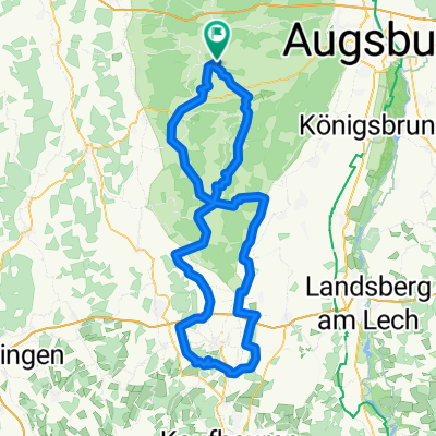
Stauden_extrem light
A cycling route starting in Dinkelscherben, Bavaria, Germany.
Overview
About this route
RTF Planung
Staudenrunde von Dinkelscherben aus.- -:--
- Duration
- 86.7 km
- Distance
- 711 m
- Ascent
- 713 m
- Descent
- ---
- Avg. speed
- ---
- Avg. speed
Route quality
Waytypes & surfaces along the route
Waytypes
Quiet road
57.8 km
(67 %)
Road
19.1 km
(22 %)
Surfaces
Paved
78.2 km
(90 %)
Unpaved
0.9 km
(1 %)
Asphalt
76 km
(88 %)
Paved (undefined)
2.1 km
(2 %)
Continue with Bikemap
Use, edit, or download this cycling route
You would like to ride Stauden_extrem light or customize it for your own trip? Here is what you can do with this Bikemap route:
Free features
- Save this route as favorite or in collections
- Copy & plan your own version of this route
- Sync your route with Garmin or Wahoo
Premium features
Free trial for 3 days, or one-time payment. More about Bikemap Premium.
- Navigate this route on iOS & Android
- Export a GPX / KML file of this route
- Create your custom printout (try it for free)
- Download this route for offline navigation
Discover more Premium features.
Get Bikemap PremiumFrom our community
Other popular routes starting in Dinkelscherben
- Dinkelscherben-Burgau (kurz)
- Distance
- 54.8 km
- Ascent
- 350 m
- Descent
- 330 m
- Location
- Dinkelscherben, Bavaria, Germany
- Rennradtour von Dinkelscherben nach Maria Steinbach
- Distance
- 174.6 km
- Ascent
- 855 m
- Descent
- 852 m
- Location
- Dinkelscherben, Bavaria, Germany
- Rennrad-Tour "In-die-Stauden"
- Distance
- 53.8 km
- Ascent
- 415 m
- Descent
- 410 m
- Location
- Dinkelscherben, Bavaria, Germany
- Cappuccino Training lang 05.09.2020
- Distance
- 71.1 km
- Ascent
- 338 m
- Descent
- 340 m
- Location
- Dinkelscherben, Bavaria, Germany
- RTF Dinkelscherben 2008
- Distance
- 132.3 km
- Ascent
- 900 m
- Descent
- 867 m
- Location
- Dinkelscherben, Bavaria, Germany
- Westliche Wälder Dinkelscherben Zusmarshausen Diedorf
- Distance
- 47.9 km
- Ascent
- 450 m
- Descent
- 452 m
- Location
- Dinkelscherben, Bavaria, Germany
- Rennrad-Tour Dinkelscherben - Jettingen - Burtenbach
- Distance
- 44.5 km
- Ascent
- 332 m
- Descent
- 316 m
- Location
- Dinkelscherben, Bavaria, Germany
- Lützelburg gekürzt
- Distance
- 60.2 km
- Ascent
- 304 m
- Descent
- 304 m
- Location
- Dinkelscherben, Bavaria, Germany
Open it in the app