Ялта - Ай-Петри - Чайный домик - Голубинка - Байдары - Ялта
A cycling route starting in Livadia, Autonomous Republic of Crimea, Ukraine.
Overview
About this route
No description yet!
- -:--
- Duration
- 129.2 km
- Distance
- 2,076 m
- Ascent
- 2,159 m
- Descent
- ---
- Avg. speed
- ---
- Max. altitude
Route highlights
Points of interest along the route
Point of interest after 58.4 km
Continue with Bikemap
Use, edit, or download this cycling route
You would like to ride Ялта - Ай-Петри - Чайный домик - Голубинка - Байдары - Ялта or customize it for your own trip? Here is what you can do with this Bikemap route:
Free features
- Save this route as favorite or in collections
- Copy & plan your own version of this route
- Split it into stages to create a multi-day tour
- Sync your route with Garmin or Wahoo
Premium features
Free trial for 3 days, or one-time payment. More about Bikemap Premium.
- Navigate this route on iOS & Android
- Export a GPX / KML file of this route
- Create your custom printout (try it for free)
- Download this route for offline navigation
Discover more Premium features.
Get Bikemap PremiumFrom our community
Other popular routes starting in Livadia
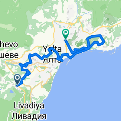
- От с. Курпаты до улица Киевская 42, Ялта
- Distance
- 12.1 km
- Ascent
- 148 m
- Descent
- 182 m
- Location
- Livadia, Autonomous Republic of Crimea, Ukraine
- Маршрут №1 "Ливадия - Ласточка"
- Distance
- 9.6 km
- Ascent
- 231 m
- Descent
- 386 m
- Location
- Livadia, Autonomous Republic of Crimea, Ukraine
- Ливадия-Массандра
- Distance
- 9.3 km
- Ascent
- 171 m
- Descent
- 382 m
- Location
- Livadia, Autonomous Republic of Crimea, Ukraine
- Ялта - Большой Каньон - Ат-Баш
- Distance
- 50.6 km
- Ascent
- 2,448 m
- Descent
- 2,417 m
- Location
- Livadia, Autonomous Republic of Crimea, Ukraine
- Ялта-Ай-петри
- Distance
- 23.1 km
- Ascent
- 1,173 m
- Descent
- 62 m
- Location
- Livadia, Autonomous Republic of Crimea, Ukraine
- Yalta-Tropyu
- Distance
- 13.9 km
- Ascent
- 1,236 m
- Descent
- 391 m
- Location
- Livadia, Autonomous Republic of Crimea, Ukraine
- Царская тропа /Tsar's path/
- Distance
- 15.5 km
- Ascent
- 448 m
- Descent
- 448 m
- Location
- Livadia, Autonomous Republic of Crimea, Ukraine
- 24 -Yalta-Alupka-Solnechnaya-Yalta (32-510-15,9)
- Distance
- 33.4 km
- Ascent
- 468 m
- Descent
- 688 m
- Location
- Livadia, Autonomous Republic of Crimea, Ukraine
Open it in the app