

Kühschlag Acht 2
A cycling route starting in Nittendorf, Bavaria, Germany.
Overview
About this route
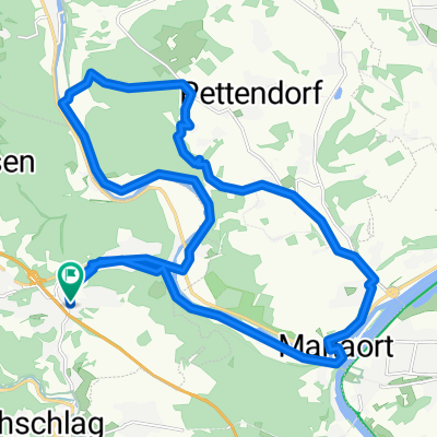
Beautiful up-and-down tour around Kühschlag
- -:--
- Duration
- 30.3 km
- Distance
- 369 m
- Ascent
- 375 m
- Descent
- ---
- Avg. speed
- ---
- Max. altitude
Route quality
Waytypes & surfaces along the route
Waytypes
Track
11.5 km
(38 %)
Quiet road
10 km
(33 %)
Surfaces
Paved
10.9 km
(36 %)
Unpaved
12.1 km
(40 %)
Asphalt
10 km
(33 %)
Gravel
10 km
(33 %)
Continue with Bikemap
Use, edit, or download this cycling route
You would like to ride Kühschlag Acht 2 or customize it for your own trip? Here is what you can do with this Bikemap route:
Free features
- Save this route as favorite or in collections
- Copy & plan your own version of this route
- Sync your route with Garmin or Wahoo
Premium features
Free trial for 3 days, or one-time payment. More about Bikemap Premium.
- Navigate this route on iOS & Android
- Export a GPX / KML file of this route
- Create your custom printout (try it for free)
- Download this route for offline navigation
Discover more Premium features.
Get Bikemap PremiumFrom our community
Other popular routes starting in Nittendorf
 Thumhausen Runde über Grafenried
- Distance
- 27.5 km
- Ascent
- 390 m
- Descent
- 390 m
- Location
- Nittendorf, Bavaria, Germany
 Adlersberg Runde
- Distance
- 25.7 km
- Ascent
- 349 m
- Descent
- 349 m
- Location
- Nittendorf, Bavaria, Germany
 Kühschlag Acht 2
- Distance
- 30.3 km
- Ascent
- 369 m
- Descent
- 375 m
- Location
- Nittendorf, Bavaria, Germany
 Kühschlag Runde über Thumhausen
- Distance
- 17.8 km
- Ascent
- 334 m
- Descent
- 334 m
- Location
- Nittendorf, Bavaria, Germany
 Pielenhofen Runde über Frauenberg
- Distance
- 24.2 km
- Ascent
- 286 m
- Descent
- 286 m
- Location
- Nittendorf, Bavaria, Germany
 Seilfähre Matting
- Distance
- 33.2 km
- Ascent
- 206 m
- Descent
- 246 m
- Location
- Nittendorf, Bavaria, Germany
 Laaber Kreuzweg Extended 2
- Distance
- 28.7 km
- Ascent
- 373 m
- Descent
- 373 m
- Location
- Nittendorf, Bavaria, Germany
 Labertal - Sinzing - Eilsbrunn - Undorf
- Distance
- 23.8 km
- Ascent
- 277 m
- Descent
- 326 m
- Location
- Nittendorf, Bavaria, Germany
Open it in the app