

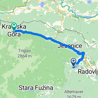
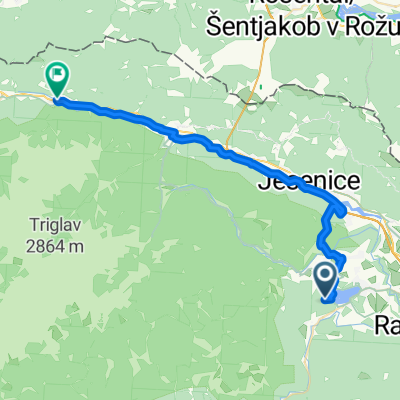
Bled-Kranjska Gora
A cycling route starting in Zgornje Gorje, Municipality of Gorje, Slovenia.
Overview
About this route
2013.07.06. 19:52
- -:--
- Duration
- 36.4 km
- Distance
- 592 m
- Ascent
- 253 m
- Descent
- ---
- Avg. speed
- ---
- Max. altitude

Route quality
Waytypes & surfaces along the route
Waytypes
Road
17.8 km
(49 %)
Cycleway
12.4 km
(34 %)
Surfaces
Paved
33.5 km
(92 %)
Unpaved
1.1 km
(3 %)
Asphalt
19.3 km
(53 %)
Paved (undefined)
14.2 km
(39 %)
Continue with Bikemap
Use, edit, or download this cycling route
You would like to ride Bled-Kranjska Gora or customize it for your own trip? Here is what you can do with this Bikemap route:
Free features
- Save this route as favorite or in collections
- Copy & plan your own version of this route
- Sync your route with Garmin or Wahoo
Premium features
Free trial for 3 days, or one-time payment. More about Bikemap Premium.
- Navigate this route on iOS & Android
- Export a GPX / KML file of this route
- Create your custom printout (try it for free)
- Download this route for offline navigation
Discover more Premium features.
Get Bikemap PremiumFrom our community
Other popular routes starting in Zgornje Gorje
 Bled, Bled to Vitranška ulica, Kranjska Gora
- Distance
- 41 km
- Ascent
- 900 m
- Descent
- 581 m
- Location
- Zgornje Gorje, Municipality of Gorje, Slovenia
 Bosques de Bled
- Distance
- 14.8 km
- Ascent
- 549 m
- Descent
- 552 m
- Location
- Zgornje Gorje, Municipality of Gorje, Slovenia
 Bled, Bled to Jezerci, Gozd Martuljek
- Distance
- 33.7 km
- Ascent
- 814 m
- Descent
- 591 m
- Location
- Zgornje Gorje, Municipality of Gorje, Slovenia
 pokljuka family
- Distance
- 29.1 km
- Ascent
- 866 m
- Descent
- 862 m
- Location
- Zgornje Gorje, Municipality of Gorje, Slovenia
 Rundweg durch die Vintgar-Schlucht
- Distance
- 5.6 km
- Ascent
- 242 m
- Descent
- 239 m
- Location
- Zgornje Gorje, Municipality of Gorje, Slovenia
 Bled to Bohinj Route 2 - Final
- Distance
- 32.7 km
- Ascent
- 1,391 m
- Descent
- 1,415 m
- Location
- Zgornje Gorje, Municipality of Gorje, Slovenia
 Kranjska gora s Krmo
- Distance
- 75.3 km
- Ascent
- 683 m
- Descent
- 671 m
- Location
- Zgornje Gorje, Municipality of Gorje, Slovenia
 zabajto čez galetovec
- Distance
- 17.2 km
- Ascent
- 802 m
- Descent
- 914 m
- Location
- Zgornje Gorje, Municipality of Gorje, Slovenia
Open it in the app