Moezel volledig Fietsroute.
- 603.4 km
- 214 m
- 586 m
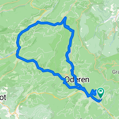
- Saint-Amarin, Grand Est, France
A cycling route starting in Saint-Amarin, Grand Est, France.
Overview
Hundsrück
Ballon d'Amsace
Planche des Belles-Filles
Ballon de Servance
Bussang
Grand Ballon via Vue des Alpes / le Haag
created this 16 years ago
Route quality
Road
39.2 km
(24 %)
Quiet road
26.2 km
(16 %)
Paved
94.8 km
(58 %)
Unpaved
4.9 km
(3 %)
Asphalt
94.8 km
(58 %)
Ground
3.3 km
(2 %)
Continue with Bikemap
You would like to ride Vosges 18/07/2009 or customize it for your own trip? Here is what you can do with this Bikemap route:
Free trial for 3 days, or one-time payment. More about Bikemap Premium.
Discover more Premium features.
Get Bikemap PremiumFrom our community
Open it in the app