

Linkou-林口 to Dayuan-大圓
A cycling route starting in Taoyuan District, Taiwan, Taiwan.
Overview
About this route
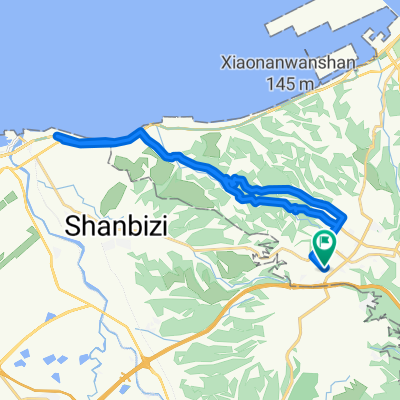
This is a nice typical ride down 106 with it's lovely curves going out towards the beach along highway 15. While head towards Dayuan, you can ride at speed with a minor uphill. Then turn-around at the major intersection via the underpass and do some more speed work coming back. 106 up the valley provides good slow work up with some really nice farm views in taking the valley back road back into Linkou. Kilometer 27 to 28.5 is probably some of the toughest climbing I've encountered yet on a group ride. Just short and steep. A granny gear for me, finally...
- -:--
- Duration
- 32.2 km
- Distance
- 310 m
- Ascent
- 310 m
- Descent
- ---
- Avg. speed
- ---
- Max. altitude

Continue with Bikemap
Use, edit, or download this cycling route
You would like to ride Linkou-林口 to Dayuan-大圓 or customize it for your own trip? Here is what you can do with this Bikemap route:
Free features
- Save this route as favorite or in collections
- Copy & plan your own version of this route
- Sync your route with Garmin or Wahoo
Premium features
Free trial for 3 days, or one-time payment. More about Bikemap Premium.
- Navigate this route on iOS & Android
- Export a GPX / KML file of this route
- Create your custom printout (try it for free)
- Download this route for offline navigation
Discover more Premium features.
Get Bikemap PremiumFrom our community
Other popular routes starting in Taoyuan District
 樹琳大棟山
樹琳大棟山- Distance
- 4.4 km
- Ascent
- 369 m
- Descent
- 80 m
- Location
- Taoyuan District, Taiwan, Taiwan
 100.03.12 鶯歌到三坑 <慢騎cloub>
- Distance
- 43.1 km
- Ascent
- 224 m
- Descent
- 224 m
- Location
- Taoyuan District, Taiwan, Taiwan
 熊空茶園
熊空茶園- Distance
- 15.5 km
- Ascent
- 805 m
- Descent
- 146 m
- Location
- Taoyuan District, Taiwan, Taiwan
 民和到大榕樹
- Distance
- 4.4 km
- Ascent
- 382 m
- Descent
- 92 m
- Location
- Taoyuan District, Taiwan, Taiwan
 宇老滿貫
宇老滿貫- Distance
- 139.4 km
- Ascent
- 2,047 m
- Descent
- 2,051 m
- Location
- Taoyuan District, Taiwan, Taiwan
 鶯歌到大溪
鶯歌到大溪- Distance
- 13.7 km
- Ascent
- 160 m
- Descent
- 84 m
- Location
- Taoyuan District, Taiwan, Taiwan
 羅馬公路自由行
- Distance
- 97.4 km
- Ascent
- 0 m
- Descent
- 0 m
- Location
- Taoyuan District, Taiwan, Taiwan
 Linkou-林口 to Dayuan-大圓
- Distance
- 32.2 km
- Ascent
- 310 m
- Descent
- 310 m
- Location
- Taoyuan District, Taiwan, Taiwan
Open it in the app