Parcours tranquille
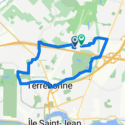
A cycling route starting in Terrebonne, Quebec, Canada.
Overview
About this route
Stationnement au coin de montée Dumais et chemin St-Charles au terrain vague
- -:--
- Duration
- 44.1 km
- Distance
- 44 m
- Ascent
- 42 m
- Descent
- ---
- Avg. speed
- ---
- Max. altitude
Route quality
Waytypes & surfaces along the route
Waytypes
Road
31 km
(70 %)
Busy road
8 km
(18 %)
Surfaces
Paved
36 km
(82 %)
Asphalt
21.5 km
(49 %)
Paved (undefined)
14.5 km
(33 %)
Continue with Bikemap
Use, edit, or download this cycling route
You would like to ride Parcours tranquille or customize it for your own trip? Here is what you can do with this Bikemap route:
Free features
- Save this route as favorite or in collections
- Copy & plan your own version of this route
- Sync your route with Garmin or Wahoo
Premium features
Free trial for 3 days, or one-time payment. More about Bikemap Premium.
- Navigate this route on iOS & Android
- Export a GPX / KML file of this route
- Create your custom printout (try it for free)
- Download this route for offline navigation
Discover more Premium features.
Get Bikemap PremiumFrom our community
Other popular routes starting in Terrebonne
- Terrebonne-Seigneurie des plaines-Terrebonne
- Distance
- 56.4 km
- Ascent
- 229 m
- Descent
- 227 m
- Location
- Terrebonne, Quebec, Canada
- trail laplaine
- Distance
- 9.4 km
- Ascent
- 222 m
- Descent
- 236 m
- Location
- Terrebonne, Quebec, Canada
- Route to Blainville QC
- Distance
- 32.4 km
- Ascent
- 89 m
- Descent
- 76 m
- Location
- Terrebonne, Quebec, Canada
- De 441 Rue des Érables, Terrebonne à 439 Rue des Érables, Terrebonne
- Distance
- 34 km
- Ascent
- 22 m
- Descent
- 74 m
- Location
- Terrebonne, Quebec, Canada
- Rue de la Mistassini, Terrebonne à Aut Jean-Lesage, Boucherville
- Distance
- 45.8 km
- Ascent
- 142 m
- Descent
- 172 m
- Location
- Terrebonne, Quebec, Canada
- Boucle de l'est
- Distance
- 46.3 km
- Ascent
- 44 m
- Descent
- 40 m
- Location
- Terrebonne, Quebec, Canada
- Pointe de l'ile 34km
- Distance
- 34.7 km
- Ascent
- 61 m
- Descent
- 61 m
- Location
- Terrebonne, Quebec, Canada
- 2915 Boul de la Pinière, Terrebonne to 185 Rue Durand, Saint-Jérôme
- Distance
- 30 km
- Ascent
- 20 m
- Descent
- 0 m
- Location
- Terrebonne, Quebec, Canada
Open it in the app