

TTR-S & NSR-E
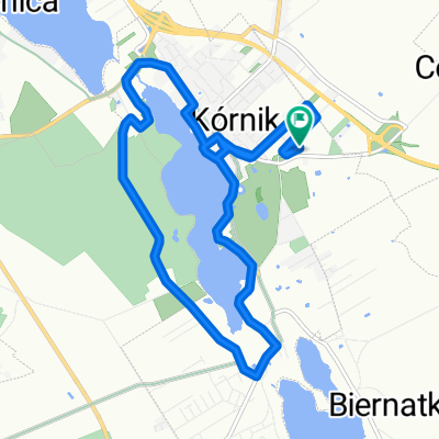
A cycling route starting in Kórnik, Greater Poland Voivodeship, Poland.
Overview
About this route
Trasa na jeden dzień. Piękne widoki, zabytki Wielkopolski, parki krajobrazowe.
- -:--
- Duration
- 120.2 km
- Distance
- 115 m
- Ascent
- 120 m
- Descent
- ---
- Avg. speed
- ---
- Max. altitude

Route quality
Waytypes & surfaces along the route
Waytypes
Track
39.7 km
(33 %)
Road
33.6 km
(28 %)
Surfaces
Paved
55.3 km
(46 %)
Unpaved
24 km
(20 %)
Asphalt
52.9 km
(44 %)
Gravel
18 km
(15 %)
Continue with Bikemap
Use, edit, or download this cycling route
You would like to ride TTR-S & NSR-E or customize it for your own trip? Here is what you can do with this Bikemap route:
Free features
- Save this route as favorite or in collections
- Copy & plan your own version of this route
- Split it into stages to create a multi-day tour
- Sync your route with Garmin or Wahoo
Premium features
Free trial for 3 days, or one-time payment. More about Bikemap Premium.
- Navigate this route on iOS & Android
- Export a GPX / KML file of this route
- Create your custom printout (try it for free)
- Download this route for offline navigation
Discover more Premium features.
Get Bikemap PremiumFrom our community
Other popular routes starting in Kórnik
 Powolna trasa w Kórnik
- Distance
- 12 km
- Ascent
- 73 m
- Descent
- 72 m
- Location
- Kórnik, Greater Poland Voivodeship, Poland
 KÓRNICKI PIERŚCIEŃ ROWEROWY
- Distance
- 55.1 km
- Ascent
- 97 m
- Descent
- 97 m
- Location
- Kórnik, Greater Poland Voivodeship, Poland
 Pogorzelica-przeprawa
- Distance
- 107.7 km
- Ascent
- 154 m
- Descent
- 154 m
- Location
- Kórnik, Greater Poland Voivodeship, Poland
 Bnin - Hermanów
- Distance
- 62.1 km
- Ascent
- 101 m
- Descent
- 97 m
- Location
- Kórnik, Greater Poland Voivodeship, Poland
 Lokalne nabijanie kilosów
- Distance
- 34.7 km
- Ascent
- 87 m
- Descent
- 87 m
- Location
- Kórnik, Greater Poland Voivodeship, Poland
 Sobotnie otwarcie
- Distance
- 17.8 km
- Ascent
- 32 m
- Descent
- 33 m
- Location
- Kórnik, Greater Poland Voivodeship, Poland
 Kórnik - Zaniemyśl - Czmoniec
- Distance
- 55.2 km
- Ascent
- 97 m
- Descent
- 97 m
- Location
- Kórnik, Greater Poland Voivodeship, Poland
 Poznańska 77, Kórnik do Romana Maya 127A, Poznań
- Distance
- 20 km
- Ascent
- 129 m
- Descent
- 130 m
- Location
- Kórnik, Greater Poland Voivodeship, Poland
Open it in the app