

Von Aletshausen in die westlichen Wälder
A cycling route starting in Aletshausen, Bavaria, Germany.
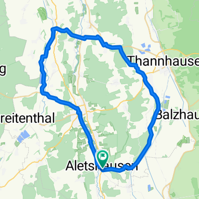
Overview
About this route
The first kilometers from Aletshausen to Thannhausen have been created with the route planner. I'm not sure if they will work so well. The rest was recorded by my GPS device.
Nice tour on very small but always paved roads. For road cyclists who value quiet little roads more and don't focus too much on their average.
- -:--
- Duration
- 113.7 km
- Distance
- 1,001 m
- Ascent
- 998 m
- Descent
- ---
- Avg. speed
- 604 m
- Max. altitude
Route quality
Waytypes & surfaces along the route
Waytypes
Quiet road
62.5 km
(55 %)
Road
22.7 km
(20 %)
Surfaces
Paved
101.2 km
(89 %)
Unpaved
1.1 km
(1 %)
Asphalt
78.5 km
(69 %)
Paved (undefined)
22.7 km
(20 %)
Continue with Bikemap
Use, edit, or download this cycling route
You would like to ride Von Aletshausen in die westlichen Wälder or customize it for your own trip? Here is what you can do with this Bikemap route:
Free features
- Save this route as favorite or in collections
- Copy & plan your own version of this route
- Split it into stages to create a multi-day tour
- Sync your route with Garmin or Wahoo
Premium features
Free trial for 3 days, or one-time payment. More about Bikemap Premium.
- Navigate this route on iOS & Android
- Export a GPX / KML file of this route
- Create your custom printout (try it for free)
- Download this route for offline navigation
Discover more Premium features.
Get Bikemap PremiumFrom our community
Other popular routes starting in Aletshausen
 Mindelheim
- Distance
- 54.4 km
- Ascent
- 273 m
- Descent
- 276 m
- Location
- Aletshausen, Bavaria, Germany
 Krumbadtrail
- Distance
- 27.2 km
- Ascent
- 348 m
- Descent
- 349 m
- Location
- Aletshausen, Bavaria, Germany
 Mindeltalradweg - Lkr. GZ
- Distance
- 45.1 km
- Ascent
- 11 m
- Descent
- 91 m
- Location
- Aletshausen, Bavaria, Germany
 Radrunde durch Aletshausen
- Distance
- 16.4 km
- Ascent
- 173 m
- Descent
- 175 m
- Location
- Aletshausen, Bavaria, Germany
 Runde Nord
- Distance
- 39.9 km
- Ascent
- 333 m
- Descent
- 331 m
- Location
- Aletshausen, Bavaria, Germany
 Von Aletshausen in die westlichen Wälder
- Distance
- 113.7 km
- Ascent
- 1,001 m
- Descent
- 998 m
- Location
- Aletshausen, Bavaria, Germany
 Vom Kammel- ins Wertachtal und zurück
- Distance
- 106.5 km
- Ascent
- 729 m
- Descent
- 696 m
- Location
- Aletshausen, Bavaria, Germany
 Aletshausen nach Ettringen
- Distance
- 27.9 km
- Ascent
- 417 m
- Descent
- 363 m
- Location
- Aletshausen, Bavaria, Germany
Open it in the app