

Grenoble-Col de la Madeleine
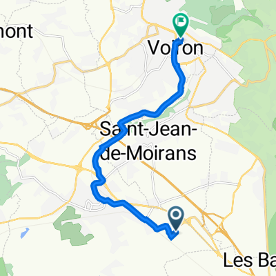
A cycling route starting in Saint-Jean-de-Moirans, Auvergne-Rhône-Alpes, France.
Overview
About this route
- STAGE - Friday, July 19, 2013 - BOURG-D'ASANS > LE GRAND-BORNAND - 204.5 km
- -:--
- Duration
- 137.6 km
- Distance
- 3,294 m
- Ascent
- 1,736 m
- Descent
- ---
- Avg. speed
- ---
- Max. altitude

Route quality
Waytypes & surfaces along the route
Waytypes
Quiet road
6.9 km
(5 %)
Cycleway
5.5 km
(4 %)
Surfaces
Paved
96.3 km
(70 %)
Unpaved
1.4 km
(1 %)
Asphalt
96.3 km
(70 %)
Gravel
1.4 km
(1 %)
Undefined
39.9 km
(29 %)
Continue with Bikemap
Use, edit, or download this cycling route
You would like to ride Grenoble-Col de la Madeleine or customize it for your own trip? Here is what you can do with this Bikemap route:
Free features
- Save this route as favorite or in collections
- Copy & plan your own version of this route
- Split it into stages to create a multi-day tour
- Sync your route with Garmin or Wahoo
Premium features
Free trial for 3 days, or one-time payment. More about Bikemap Premium.
- Navigate this route on iOS & Android
- Export a GPX / KML file of this route
- Create your custom printout (try it for free)
- Download this route for offline navigation
Discover more Premium features.
Get Bikemap PremiumFrom our community
Other popular routes starting in Saint-Jean-de-Moirans
 Fünfter Tag
- Distance
- 90.5 km
- Ascent
- 909 m
- Descent
- 957 m
- Location
- Saint-Jean-de-Moirans, Auvergne-Rhône-Alpes, France
 rando hibou
- Distance
- 11.3 km
- Ascent
- 247 m
- Descent
- 72 m
- Location
- Saint-Jean-de-Moirans, Auvergne-Rhône-Alpes, France
 137 Rue de Mayoussard, Moirans à 18 Rue Rose-Sage, Voiron
- Distance
- 8.8 km
- Ascent
- 132 m
- Descent
- 30 m
- Location
- Saint-Jean-de-Moirans, Auvergne-Rhône-Alpes, France
 137 Rue de Mayoussard, Moirans à 18 Rue Rose-Sage, Voiron
- Distance
- 7.3 km
- Ascent
- 125 m
- Descent
- 20 m
- Location
- Saint-Jean-de-Moirans, Auvergne-Rhône-Alpes, France
 La buisse
- Distance
- 8.1 km
- Ascent
- 439 m
- Descent
- 186 m
- Location
- Saint-Jean-de-Moirans, Auvergne-Rhône-Alpes, France
 288 Rue de Corporat, Moirans à 137 Rue de Mayoussard, Moirans
- Distance
- 1 km
- Ascent
- 4 m
- Descent
- 3 m
- Location
- Saint-Jean-de-Moirans, Auvergne-Rhône-Alpes, France
 Grenoble - Col de Manse
- Distance
- 122.4 km
- Ascent
- 1,855 m
- Descent
- 777 m
- Location
- Saint-Jean-de-Moirans, Auvergne-Rhône-Alpes, France
 Grenoble-Reallon
- Distance
- 169.8 km
- Ascent
- 2,452 m
- Descent
- 1,769 m
- Location
- Saint-Jean-de-Moirans, Auvergne-Rhône-Alpes, France
Open it in the app