

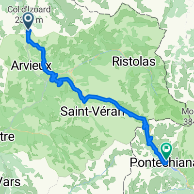
Col de L'Izoard - Briancon - Guillestre
A cycling route starting in Villar-Saint-Pancrace, Provence-Alpes-Côte d'Azur Region, France.
Overview
About this route
Second part of the tour to Col de l'Izoard with return to Guillestre
- -:--
- Duration
- 60.3 km
- Distance
- 405 m
- Ascent
- 1,872 m
- Descent
- ---
- Avg. speed
- ---
- Max. altitude

Route quality
Waytypes & surfaces along the route
Waytypes
Road
13.9 km
(23 %)
Undefined
46.4 km
(77 %)
Surfaces
Paved
38 km
(63 %)
Asphalt
38 km
(63 %)
Undefined
22.3 km
(37 %)
Continue with Bikemap
Use, edit, or download this cycling route
You would like to ride Col de L'Izoard - Briancon - Guillestre or customize it for your own trip? Here is what you can do with this Bikemap route:
Free features
- Save this route as favorite or in collections
- Copy & plan your own version of this route
- Sync your route with Garmin or Wahoo
Premium features
Free trial for 3 days, or one-time payment. More about Bikemap Premium.
- Navigate this route on iOS & Android
- Export a GPX / KML file of this route
- Create your custom printout (try it for free)
- Download this route for offline navigation
Discover more Premium features.
Get Bikemap PremiumFrom our community
Other popular routes starting in Villar-Saint-Pancrace
 Briacon -> Sestiere
- Distance
- 73.2 km
- Ascent
- 1,833 m
- Descent
- 1,833 m
- Location
- Villar-Saint-Pancrace, Provence-Alpes-Côte d'Azur Region, France
 Tour de France 2016 dzień 11
- Distance
- 136.3 km
- Ascent
- 326 m
- Descent
- 1,054 m
- Location
- Villar-Saint-Pancrace, Provence-Alpes-Côte d'Azur Region, France
 Camping Prelles naar Fort Briancon.
- Distance
- 28 km
- Ascent
- 856 m
- Descent
- 854 m
- Location
- Villar-Saint-Pancrace, Provence-Alpes-Côte d'Azur Region, France
 alpen2015-tag2+3
- Distance
- 190.9 km
- Ascent
- 3,092 m
- Descent
- 4,533 m
- Location
- Villar-Saint-Pancrace, Provence-Alpes-Côte d'Azur Region, France
 Col de L'Izoard - Briancon - Guillestre
- Distance
- 60.3 km
- Ascent
- 405 m
- Descent
- 1,872 m
- Location
- Villar-Saint-Pancrace, Provence-Alpes-Côte d'Azur Region, France
 alpen2015-tag2
- Distance
- 44.2 km
- Ascent
- 1,232 m
- Descent
- 1,701 m
- Location
- Villar-Saint-Pancrace, Provence-Alpes-Côte d'Azur Region, France
 0816-Napo-Pontechi
- Distance
- 54.8 km
- Ascent
- 1,949 m
- Descent
- 2,523 m
- Location
- Villar-Saint-Pancrace, Provence-Alpes-Côte d'Azur Region, France
 Isoardovskej okruh
- Distance
- 85.2 km
- Ascent
- 1,604 m
- Descent
- 1,601 m
- Location
- Villar-Saint-Pancrace, Provence-Alpes-Côte d'Azur Region, France
Open it in the app