

Glen Valley Hills
A cycling route starting in Langley, British Columbia, Canada.
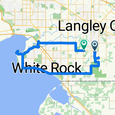
Overview
About this route
Hill Ride
- -:--
- Duration
- 44.3 km
- Distance
- 254 m
- Ascent
- 251 m
- Descent
- ---
- Avg. speed
- ---
- Max. altitude
Route quality
Waytypes & surfaces along the route
Waytypes
Road
9.3 km
(21 %)
Quiet road
7.1 km
(16 %)
Surfaces
Paved
23.5 km
(53 %)
Asphalt
23.5 km
(53 %)
Undefined
20.8 km
(47 %)
Continue with Bikemap
Use, edit, or download this cycling route
You would like to ride Glen Valley Hills or customize it for your own trip? Here is what you can do with this Bikemap route:
Free features
- Save this route as favorite or in collections
- Copy & plan your own version of this route
- Sync your route with Garmin or Wahoo
Premium features
Free trial for 3 days, or one-time payment. More about Bikemap Premium.
- Navigate this route on iOS & Android
- Export a GPX / KML file of this route
- Create your custom printout (try it for free)
- Download this route for offline navigation
Discover more Premium features.
Get Bikemap PremiumFrom our community
Other popular routes starting in Langley
 Abbotsford Loop
- Distance
- 94.9 km
- Ascent
- 448 m
- Descent
- 448 m
- Location
- Langley, British Columbia, Canada
 Around The Hood 4
- Distance
- 16.3 km
- Ascent
- 148 m
- Descent
- 146 m
- Location
- Langley, British Columbia, Canada
 bike tour through Langley
- Distance
- 13.3 km
- Ascent
- 95 m
- Descent
- 93 m
- Location
- Langley, British Columbia, Canada
 Sunrise Lake to White Rock Crescent Beach
- Distance
- 47.7 km
- Ascent
- 317 m
- Descent
- 322 m
- Location
- Langley, British Columbia, Canada
 19121 70 Ave, Surrey to 7987–8059 264 St, Langley
- Distance
- 20.1 km
- Ascent
- 55 m
- Descent
- 134 m
- Location
- Langley, British Columbia, Canada
 Hike Nicomekl Trail and Dog Parks Langley 12 km
- Distance
- 12.5 km
- Ascent
- 106 m
- Descent
- 106 m
- Location
- Langley, British Columbia, Canada
 19462–19498 73 Ave, Surrey to 7289 196 St, Surrey
- Distance
- 32.2 km
- Ascent
- 10 m
- Descent
- 90 m
- Location
- Langley, British Columbia, Canada
 # 2 Route Hills and flat riding
- Distance
- 80.3 km
- Ascent
- 280 m
- Descent
- 270 m
- Location
- Langley, British Columbia, Canada
Open it in the app