

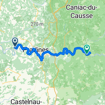
07_Albas>Aiguillon
A cycling route starting in Luzech, Occitanie, France.
Overview
About this route
: =/
- -:--
- Duration
- 122 km
- Distance
- 227 m
- Ascent
- 317 m
- Descent
- ---
- Avg. speed
- ---
- Max. altitude
Route quality
Waytypes & surfaces along the route
Waytypes
Quiet road
52.1 km
(43 %)
Busy road
31.8 km
(26 %)
Surfaces
Paved
31.4 km
(26 %)
Unpaved
0.9 km
(<1 %)
Asphalt
31.1 km
(26 %)
Gravel
0.9 km
(<1 %)
Continue with Bikemap
Use, edit, or download this cycling route
You would like to ride 07_Albas>Aiguillon or customize it for your own trip? Here is what you can do with this Bikemap route:
Free features
- Save this route as favorite or in collections
- Copy & plan your own version of this route
- Split it into stages to create a multi-day tour
- Sync your route with Garmin or Wahoo
Premium features
Free trial for 3 days, or one-time payment. More about Bikemap Premium.
- Navigate this route on iOS & Android
- Export a GPX / KML file of this route
- Create your custom printout (try it for free)
- Download this route for offline navigation
Discover more Premium features.
Get Bikemap PremiumFrom our community
Other popular routes starting in Luzech
 FdO CP3 Caumont
- Distance
- 102.4 km
- Ascent
- 855 m
- Descent
- 910 m
- Location
- Luzech, Occitanie, France
 CB2014#3 - Luzech Villeneuve s/ Lot
- Distance
- 85.2 km
- Ascent
- 324 m
- Descent
- 367 m
- Location
- Luzech, Occitanie, France
 30K MONGESTY - LE FAU
- Distance
- 29.8 km
- Ascent
- 395 m
- Descent
- 398 m
- Location
- Luzech, Occitanie, France
 30K MONGESTY - CAZALS PAR BOURDOU
- Distance
- 28.3 km
- Ascent
- 511 m
- Descent
- 506 m
- Location
- Luzech, Occitanie, France
 Luzech - St-Cirq-Lapopie
- Distance
- 55.5 km
- Ascent
- 471 m
- Descent
- 358 m
- Location
- Luzech, Occitanie, France
 15K MONGESTY - LES ARQUES
- Distance
- 15.2 km
- Ascent
- 316 m
- Descent
- 330 m
- Location
- Luzech, Occitanie, France
 07_Albas>Aiguillon
- Distance
- 122 km
- Ascent
- 227 m
- Descent
- 317 m
- Location
- Luzech, Occitanie, France
 50K MONGESTY - THEDIRAC - CAZALS - LES GUNIES
- Distance
- 49.6 km
- Ascent
- 800 m
- Descent
- 797 m
- Location
- Luzech, Occitanie, France
Open it in the app