

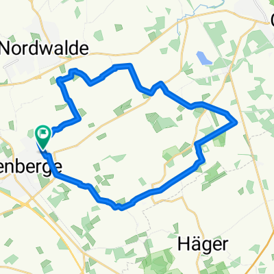
Altenberge - Emsdettener Venn ueber Scheddebrock
A cycling route starting in Altenberge, North Rhine-Westphalia, Germany.
Overview
About this route
Altenberge - Emsdettener Venn ueber Scheddebrock
- -:--
- Duration
- 19.2 km
- Distance
- 21 m
- Ascent
- 43 m
- Descent
- ---
- Avg. speed
- ---
- Avg. speed
Route quality
Waytypes & surfaces along the route
Waytypes
Quiet road
13.8 km
(72 %)
Track
3.3 km
(17 %)
Surfaces
Paved
9.1 km
(47 %)
Unpaved
3.3 km
(17 %)
Asphalt
7.2 km
(37 %)
Paved (undefined)
2 km
(10 %)
Route highlights
Points of interest along the route
Point of interest after 7.7 km
Schützenplatz
Point of interest after 9.7 km
Fahrrad Hütte
Continue with Bikemap
Use, edit, or download this cycling route
You would like to ride Altenberge - Emsdettener Venn ueber Scheddebrock or customize it for your own trip? Here is what you can do with this Bikemap route:
Free features
- Save this route as favorite or in collections
- Copy & plan your own version of this route
- Sync your route with Garmin or Wahoo
Premium features
Free trial for 3 days, or one-time payment. More about Bikemap Premium.
- Navigate this route on iOS & Android
- Export a GPX / KML file of this route
- Create your custom printout (try it for free)
- Download this route for offline navigation
Discover more Premium features.
Get Bikemap PremiumFrom our community
Other popular routes starting in Altenberge
 Altenberge -Max-Klemens-Kanal
- Distance
- 35.9 km
- Ascent
- 212 m
- Descent
- 212 m
- Location
- Altenberge, North Rhine-Westphalia, Germany
 Nienberge- Sprakel-Altenberge Aufnahme vom 20. Juli 14:35
- Distance
- 13.7 km
- Ascent
- 38 m
- Descent
- 78 m
- Location
- Altenberge, North Rhine-Westphalia, Germany
 Altenberge Burg-Hulshof Aufnahme vom 9. August 13:51
- Distance
- 26.3 km
- Ascent
- 87 m
- Descent
- 76 m
- Location
- Altenberge, North Rhine-Westphalia, Germany
 70,2 km - Schmedehausen-Ostbevern-Handorf-Altenberge
- Distance
- 70.2 km
- Ascent
- 82 m
- Descent
- 128 m
- Location
- Altenberge, North Rhine-Westphalia, Germany
 Altenberge -> Ahlintel -> Altenberge
- Distance
- 37.6 km
- Ascent
- 25 m
- Descent
- 38 m
- Location
- Altenberge, North Rhine-Westphalia, Germany
 Rund um Entrup/Hansell
- Distance
- 21.1 km
- Ascent
- 35 m
- Descent
- 40 m
- Location
- Altenberge, North Rhine-Westphalia, Germany
 Wasserschlösser
- Distance
- 77.3 km
- Ascent
- 229 m
- Descent
- 230 m
- Location
- Altenberge, North Rhine-Westphalia, Germany
 Altenberge - Nienberge Aufnahme vom 20. Juli 14:35
- Distance
- 13.9 km
- Ascent
- 39 m
- Descent
- 81 m
- Location
- Altenberge, North Rhine-Westphalia, Germany
Open it in the app