Oberlandrunde- Neschwitz-Liebon-Panschwitz-Rosenthal
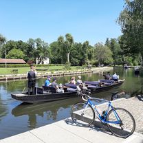
A cycling route starting in Oßling, Saxony, Germany.
Overview
About this route
Schöne Ausssichten Richtung Oberland
- -:--
- Duration
- 50.1 km
- Distance
- 186 m
- Ascent
- 186 m
- Descent
- ---
- Avg. speed
- ---
- Avg. speed
Route quality
Waytypes & surfaces along the route
Waytypes
Busy road
25.3 km
(50 %)
Road
17.8 km
(35 %)
Surfaces
Paved
41.7 km
(83 %)
Unpaved
1.2 km
(2 %)
Asphalt
41.7 km
(83 %)
Ground
0.6 km
(1 %)
Continue with Bikemap
Use, edit, or download this cycling route
You would like to ride Oberlandrunde- Neschwitz-Liebon-Panschwitz-Rosenthal or customize it for your own trip? Here is what you can do with this Bikemap route:
Free features
- Save this route as favorite or in collections
- Copy & plan your own version of this route
- Sync your route with Garmin or Wahoo
Premium features
Free trial for 3 days, or one-time payment. More about Bikemap Premium.
- Navigate this route on iOS & Android
- Export a GPX / KML file of this route
- Create your custom printout (try it for free)
- Download this route for offline navigation
Discover more Premium features.
Get Bikemap PremiumFrom our community
Other popular routes starting in Oßling
- Lübbenau- Lausizer Seeenland Tour
- Distance
- 200.8 km
- Ascent
- 803 m
- Descent
- 757 m
- Location
- Oßling, Saxony, Germany
- Oßling-Schmerlitz-Schönau-Wittichenau-Niesendorf-Naußlitz-Cunnewitz-Trado-Oßling
- Distance
- 46.5 km
- Ascent
- 88 m
- Descent
- 88 m
- Location
- Oßling, Saxony, Germany
- Kamenz - Hoyerswerder - Bernsdorf - Kamenz
- Distance
- 50.8 km
- Ascent
- 128 m
- Descent
- 117 m
- Location
- Oßling, Saxony, Germany
- Teich-Tour
- Distance
- 20.9 km
- Ascent
- 65 m
- Descent
- 65 m
- Location
- Oßling, Saxony, Germany
- Froschradweg (verkürzt)
- Distance
- 214.5 km
- Ascent
- 309 m
- Descent
- 312 m
- Location
- Oßling, Saxony, Germany
- Oßling,Kamenz,Panschwitz,Abz. Liebon,Neschwitz,Zerna,Wittichenau,Oßling
- Distance
- 62.7 km
- Ascent
- 147 m
- Descent
- 149 m
- Location
- Oßling, Saxony, Germany
- Oßling-Rosenthal-Schmeckwitz-Nebelschütz-Strßgräbchen-Weißig-Misltrich
- Distance
- 41.1 km
- Ascent
- 168 m
- Descent
- 171 m
- Location
- Oßling, Saxony, Germany
- Wittichenau und Großteich Deutschbaselitz
- Distance
- 33.2 km
- Ascent
- 127 m
- Descent
- 129 m
- Location
- Oßling, Saxony, Germany
Open it in the app