

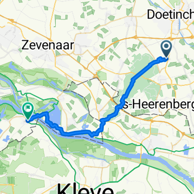
PP Braamt - Millingen aan de Rijn
A cycling route starting in Doetinchem, Gelderland, The Netherlands.
Overview
About this route
PP Deel II Braamt - Millingen aan de Rijn
- -:--
- Duration
- 23.8 km
- Distance
- 182 m
- Ascent
- 185 m
- Descent
- ---
- Avg. speed
- ---
- Max. altitude
Route quality
Waytypes & surfaces along the route
Waytypes
Quiet road
9.3 km
(39 %)
Path
4.9 km
(21 %)
Surfaces
Paved
9 km
(38 %)
Unpaved
3 km
(13 %)
Asphalt
6.5 km
(27 %)
Paving stones
2.6 km
(11 %)
Continue with Bikemap
Use, edit, or download this cycling route
You would like to ride PP Braamt - Millingen aan de Rijn or customize it for your own trip? Here is what you can do with this Bikemap route:
Free features
- Save this route as favorite or in collections
- Copy & plan your own version of this route
- Sync your route with Garmin or Wahoo
Premium features
Free trial for 3 days, or one-time payment. More about Bikemap Premium.
- Navigate this route on iOS & Android
- Export a GPX / KML file of this route
- Create your custom printout (try it for free)
- Download this route for offline navigation
Discover more Premium features.
Get Bikemap PremiumFrom our community
Other popular routes starting in Doetinchem
 PP Braamt - Millingen aan de Rijn
- Distance
- 23.8 km
- Ascent
- 182 m
- Descent
- 185 m
- Location
- Doetinchem, Gelderland, The Netherlands
 2 Tage mit Mölle .. Tag 2
- Distance
- 113.4 km
- Ascent
- 165 m
- Descent
- 159 m
- Location
- Doetinchem, Gelderland, The Netherlands
 Hummeloën
- Distance
- 30.7 km
- Ascent
- 78 m
- Descent
- 81 m
- Location
- Doetinchem, Gelderland, The Netherlands
 route 1 met bike map
- Distance
- 76.7 km
- Ascent
- 38 m
- Descent
- 37 m
- Location
- Doetinchem, Gelderland, The Netherlands
 Fietsroute Montferland e.o.
- Distance
- 76.7 km
- Ascent
- 215 m
- Descent
- 214 m
- Location
- Doetinchem, Gelderland, The Netherlands
 Rondje Doesburg
- Distance
- 50.9 km
- Ascent
- 30 m
- Descent
- 30 m
- Location
- Doetinchem, Gelderland, The Netherlands
 Rondje om Groenlo
- Distance
- 74.2 km
- Ascent
- 39 m
- Descent
- 44 m
- Location
- Doetinchem, Gelderland, The Netherlands
 PP Braamt - Millingen aan de Rijn
- Distance
- 23.9 km
- Ascent
- 169 m
- Descent
- 171 m
- Location
- Doetinchem, Gelderland, The Netherlands
Open it in the app