

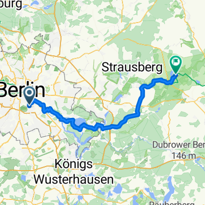
berlin-alt tellin
A cycling route starting in Treptow, State of Berlin, Germany.
Overview
About this route
berlin-alt tellin
- -:--
- Duration
- 202.2 km
- Distance
- 228 m
- Ascent
- 256 m
- Descent
- ---
- Avg. speed
- ---
- Max. altitude
Route quality
Waytypes & surfaces along the route
Waytypes
Quiet road
74.8 km
(37 %)
Track
34.4 km
(17 %)
Surfaces
Paved
145.6 km
(72 %)
Unpaved
18.2 km
(9 %)
Asphalt
141.5 km
(70 %)
Gravel
6.1 km
(3 %)
Continue with Bikemap
Use, edit, or download this cycling route
You would like to ride berlin-alt tellin or customize it for your own trip? Here is what you can do with this Bikemap route:
Free features
- Save this route as favorite or in collections
- Copy & plan your own version of this route
- Split it into stages to create a multi-day tour
- Sync your route with Garmin or Wahoo
Premium features
Free trial for 3 days, or one-time payment. More about Bikemap Premium.
- Navigate this route on iOS & Android
- Export a GPX / KML file of this route
- Create your custom printout (try it for free)
- Download this route for offline navigation
Discover more Premium features.
Get Bikemap PremiumFrom our community
Other popular routes starting in Treptow
 Rund um Schönefeld
- Distance
- 48.5 km
- Ascent
- 73 m
- Descent
- 83 m
- Location
- Treptow, State of Berlin, Germany
 Wiener Straße, Berlin to Kurfürstendamm, Berlin
- Distance
- 9.2 km
- Ascent
- 27 m
- Descent
- 36 m
- Location
- Treptow, State of Berlin, Germany
 Sunsetherbstrunde
- Distance
- 35.4 km
- Ascent
- 38 m
- Descent
- 34 m
- Location
- Treptow, State of Berlin, Germany
 nah am wasser gebaut
- Distance
- 15 km
- Ascent
- 19 m
- Descent
- 32 m
- Location
- Treptow, State of Berlin, Germany
 Berlin-Darmstadt Rennrad
- Distance
- 558.2 km
- Ascent
- 1,417 m
- Descent
- 1,315 m
- Location
- Treptow, State of Berlin, Germany
 Hermannplatz – Spandau – Havelchaussee – Wilmersdorfer Fenn
- Distance
- 58.8 km
- Ascent
- 160 m
- Descent
- 155 m
- Location
- Treptow, State of Berlin, Germany
 KW Runde
- Distance
- 80.9 km
- Ascent
- 61 m
- Descent
- 58 m
- Location
- Treptow, State of Berlin, Germany
 Treptow - Buckow
- Distance
- 70.2 km
- Ascent
- 281 m
- Descent
- 303 m
- Location
- Treptow, State of Berlin, Germany
Open it in the app