

Lieblingstrainingsrunde
A cycling route starting in Wittnau, Baden-Wurttemberg, Germany.
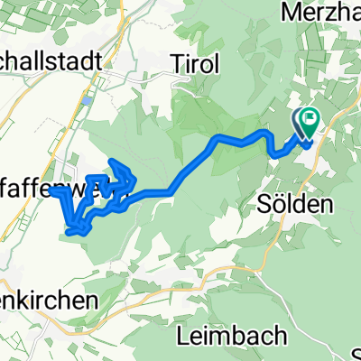
Overview
About this route
Schöni - Batzenberg - Hexental - Geiersnest
- -:--
- Duration
- 32.9 km
- Distance
- 823 m
- Ascent
- 824 m
- Descent
- ---
- Avg. speed
- ---
- Max. altitude
Route quality
Waytypes & surfaces along the route
Waytypes
Quiet road
13.8 km
(42 %)
Busy road
7.8 km
(24 %)
Surfaces
Paved
31.3 km
(95 %)
Asphalt
31.2 km
(95 %)
Paved (undefined)
0.1 km
(<1 %)
Undefined
1.6 km
(5 %)
Continue with Bikemap
Use, edit, or download this cycling route
You would like to ride Lieblingstrainingsrunde or customize it for your own trip? Here is what you can do with this Bikemap route:
Free features
- Save this route as favorite or in collections
- Copy & plan your own version of this route
- Sync your route with Garmin or Wahoo
Premium features
Free trial for 3 days, or one-time payment. More about Bikemap Premium.
- Navigate this route on iOS & Android
- Export a GPX / KML file of this route
- Create your custom printout (try it for free)
- Download this route for offline navigation
Discover more Premium features.
Get Bikemap PremiumFrom our community
Other popular routes starting in Wittnau
 Wittnau-Kohlerhof-St Ulrich-Wittnau
- Distance
- 25.8 km
- Ascent
- 1,165 m
- Descent
- 871 m
- Location
- Wittnau, Baden-Wurttemberg, Germany
 Bischofslinde
- Distance
- 9.4 km
- Ascent
- 16 m
- Descent
- 180 m
- Location
- Wittnau, Baden-Wurttemberg, Germany
 Wittnau-Pfaffenweiler-Wittnau
- Distance
- 19.1 km
- Ascent
- 585 m
- Descent
- 579 m
- Location
- Wittnau, Baden-Wurttemberg, Germany
 Große Reblandtour
- Distance
- 18.7 km
- Ascent
- 281 m
- Descent
- 281 m
- Location
- Wittnau, Baden-Wurttemberg, Germany
 Rund um den Schönberg
- Distance
- 20.4 km
- Ascent
- 520 m
- Descent
- 506 m
- Location
- Wittnau, Baden-Wurttemberg, Germany
 Schönberg 03 CLONED FROM ROUTE 199145
- Distance
- 2 km
- Ascent
- 159 m
- Descent
- 0 m
- Location
- Wittnau, Baden-Wurttemberg, Germany
 Mösleschacht, Freiburg im Breisgau nach Haierweg 21, Freiburg im Breisgau
- Distance
- 4.6 km
- Ascent
- 19 m
- Descent
- 219 m
- Location
- Wittnau, Baden-Wurttemberg, Germany
 Lieblingstrainingsrunde
- Distance
- 32.9 km
- Ascent
- 823 m
- Descent
- 824 m
- Location
- Wittnau, Baden-Wurttemberg, Germany
Open it in the app