
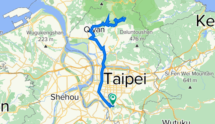
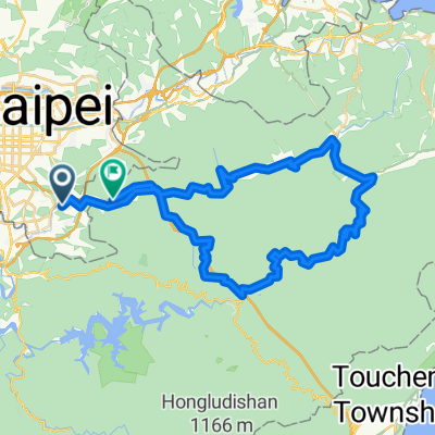
台北陽明山行
A cycling route starting in Taipei, Taipei, Taiwan.
Overview
About this route
陽明山
(cloned from route 2238983)- -:--
- Duration
- 58.5 km
- Distance
- 711 m
- Ascent
- 706 m
- Descent
- ---
- Avg. speed
- ---
- Max. altitude
Route quality
Waytypes & surfaces along the route
Waytypes
Road
29.2 km
(50 %)
Quiet road
7.6 km
(13 %)
Surfaces
Paved
27.5 km
(47 %)
Asphalt
27.5 km
(47 %)
Undefined
31 km
(53 %)
Continue with Bikemap
Use, edit, or download this cycling route
You would like to ride 台北陽明山行 or customize it for your own trip? Here is what you can do with this Bikemap route:
Free features
- Save this route as favorite or in collections
- Copy & plan your own version of this route
- Sync your route with Garmin or Wahoo
Premium features
Free trial for 3 days, or one-time payment. More about Bikemap Premium.
- Navigate this route on iOS & Android
- Export a GPX / KML file of this route
- Create your custom printout (try it for free)
- Download this route for offline navigation
Discover more Premium features.
Get Bikemap PremiumFrom our community
Other popular routes starting in Taipei
 秘境之旅-南港,汐止,平溪,石碇
- Distance
- 66.8 km
- Ascent
- 1,419 m
- Descent
- 1,418 m
- Location
- Taipei, Taipei, Taiwan
 Short bike tour through Taipei City
- Distance
- 3.2 km
- Ascent
- 295 m
- Descent
- 295 m
- Location
- Taipei, Taipei, Taiwan
 阿柔洋-政大道南橋
- Distance
- 13 km
- Ascent
- 688 m
- Descent
- 698 m
- Location
- Taipei, Taipei, Taiwan
 陽明山第五條:天元宮→巴拉卡公路→大屯山助航站
- Distance
- 15.9 km
- Ascent
- 952 m
- Descent
- 37 m
- Location
- Taipei, Taipei, Taiwan
 系列七 海王星-闊瀨尋奇
- Distance
- 82.8 km
- Ascent
- 1,299 m
- Descent
- 1,281 m
- Location
- Taipei, Taipei, Taiwan
 Taiwan tour
- Distance
- 985.3 km
- Ascent
- 1,195 m
- Descent
- 1,194 m
- Location
- Taipei, Taipei, Taiwan
 ironkidz_201510_微風車訓_FINAL
- Distance
- 40.1 km
- Ascent
- 73 m
- Descent
- 73 m
- Location
- Taipei, Taipei, Taiwan
 大稻埕→西濱→竹圍漁港→永安漁港
- Distance
- 67.8 km
- Ascent
- 95 m
- Descent
- 89 m
- Location
- Taipei, Taipei, Taiwan
Open it in the app