

"Freunde der Bergfahrt" - Tour
A cycling route starting in Hellingen, Thuringia, Germany.
Overview
About this route
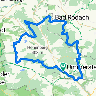
The tour begins in Heldburg, whose valuable historical old town encourages one to first fortify themselves with a second breakfast or an ice cream. This quaint town lies at the foot of a castle of the same name, which, thanks to its location on the highest elevation of the region, will be visible again and again throughout the route. However, the name "Friends of the Ascent" tour also refers to certain sporting challenges, which is evident from the first steep climb just a few kilometers in. Three more will follow. The particular scenic charm that pleases the eyes on the circular route is due to the more recent history of Germany. During GDR times, the region was in a border closure area. Thus, the Heldburg land has managed to preserve its authenticity to this day. Nature lovers will thus continually encounter many discoveries along the varied route that passes through river meadows, forests, and pastures. On hot summer days, it is recommended to make a detour towards Westhausen at kilometer 28.7. This leads the self-proclaimed "heroes" of the ascent to a swimming lake and thus to a well-deserved refreshment.
- -:--
- Duration
- 18.4 km
- Distance
- 214 m
- Ascent
- 214 m
- Descent
- ---
- Avg. speed
- ---
- Max. altitude
Route quality
Waytypes & surfaces along the route
Waytypes
Quiet road
8.7 km
(47 %)
Road
7.4 km
(40 %)
Surfaces
Paved
12.5 km
(68 %)
Unpaved
0.2 km
(1 %)
Asphalt
12.5 km
(68 %)
Gravel
0.2 km
(1 %)
Undefined
5.7 km
(31 %)
Continue with Bikemap
Use, edit, or download this cycling route
You would like to ride "Freunde der Bergfahrt" - Tour or customize it for your own trip? Here is what you can do with this Bikemap route:
Free features
- Save this route as favorite or in collections
- Copy & plan your own version of this route
- Sync your route with Garmin or Wahoo
Premium features
Free trial for 3 days, or one-time payment. More about Bikemap Premium.
- Navigate this route on iOS & Android
- Export a GPX / KML file of this route
- Create your custom printout (try it for free)
- Download this route for offline navigation
Discover more Premium features.
Get Bikemap PremiumFrom our community
Other popular routes starting in Hellingen
 Bad Colberg-Heldburg-Bad Rodach
- Distance
- 12.9 km
- Ascent
- 192 m
- Descent
- 175 m
- Location
- Hellingen, Thuringia, Germany
 Heldburg-Seßlach
- Distance
- 16.2 km
- Ascent
- 58 m
- Descent
- 80 m
- Location
- Hellingen, Thuringia, Germany
 Von Hellingen durchs Unterland
- Distance
- 54.9 km
- Ascent
- 578 m
- Descent
- 577 m
- Location
- Hellingen, Thuringia, Germany
 Grünes Band DE 06/14: Poppenhausen - Frankenheim (Rhön)
- Distance
- 75.8 km
- Ascent
- 1,271 m
- Descent
- 836 m
- Location
- Hellingen, Thuringia, Germany
 Quer durch`s Land 12.Etappe Heldburg - Grimmenthal
- Distance
- 52.6 km
- Ascent
- 251 m
- Descent
- 244 m
- Location
- Hellingen, Thuringia, Germany
 Bad Rodach Ren
- Distance
- 49.3 km
- Ascent
- 275 m
- Descent
- 262 m
- Location
- Hellingen, Thuringia, Germany
 Straufhain MTB
- Distance
- 55.4 km
- Ascent
- 627 m
- Descent
- 580 m
- Location
- Hellingen, Thuringia, Germany
 "Freunde der Bergfahrt" - Tour
- Distance
- 18.4 km
- Ascent
- 214 m
- Descent
- 214 m
- Location
- Hellingen, Thuringia, Germany
Open it in the app