

Tour entlang des "Grünen Bandes"
A cycling route starting in Hellingen, Thuringia, Germany.
Overview
About this route
<p>
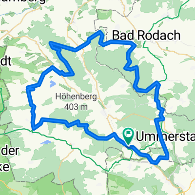
The starting point of this round tour, which takes us back to the time of the Iron Curtain, the castles, and ultimately to the era before the arrival of humans, is the medieval town of Heldburg. We thus start in the area of the former GDR, in the then 'restricted zone'. From 1954, this 5-kilometer wide strip along the border could only be entered with special permission. We will remain in this area until shortly before Bad Rodach. First, we will visit Streufdorf, whose two-country museum tells us much about German-German history. Here, in the foundations of the church fortifications, the atmosphere is already medieval. We continue our journey back in time and reach the project Hutelandschaft Rodachaue. Since 2004, this 7-hectare area has been transformed into the primordial state it had before the arrival of the first humans. Wild Konik horses and Heck cattle, storks, amphibians, insects, birds – the biodiversity is impressive. At kilometer 31.5, a cemetery with a memorial in the shadow of an old border tower again reminds us of the fate of the inhumane restricted area: Billmuthausen was destroyed and completely razed on the orders of the GDR government. The tour ends rapidly. Heldburg is reached at the height of the Veste, from which it steeply descends into the old town. There, various dining options await us.</p>
Translated, show original (German)- -:--
- Duration
- 15.6 km
- Distance
- 276 m
- Ascent
- 276 m
- Descent
- ---
- Avg. speed
- ---
- Max. altitude
Route quality
Waytypes & surfaces along the route
Waytypes
Track
6.1 km
(39 %)
Path
6.1 km
(39 %)
Surfaces
Paved
12.7 km
(81 %)
Unpaved
2.7 km
(17 %)
Asphalt
12 km
(77 %)
Gravel
2.5 km
(16 %)
Continue with Bikemap
Use, edit, or download this cycling route
You would like to ride Tour entlang des "Grünen Bandes" or customize it for your own trip? Here is what you can do with this Bikemap route:
Free features
- Save this route as favorite or in collections
- Copy & plan your own version of this route
- Sync your route with Garmin or Wahoo
Premium features
Free trial for 3 days, or one-time payment. More about Bikemap Premium.
- Navigate this route on iOS & Android
- Export a GPX / KML file of this route
- Create your custom printout (try it for free)
- Download this route for offline navigation
Discover more Premium features.
Get Bikemap PremiumFrom our community
Other popular routes starting in Hellingen
 "Freunde der Bergfahrt" - Tour
- Distance
- 18.4 km
- Ascent
- 214 m
- Descent
- 214 m
- Location
- Hellingen, Thuringia, Germany
 Bad Colberg-Heldburg-Bad Rodach
- Distance
- 12.9 km
- Ascent
- 192 m
- Descent
- 175 m
- Location
- Hellingen, Thuringia, Germany
 Bad Rodach Ren
- Distance
- 49.3 km
- Ascent
- 275 m
- Descent
- 262 m
- Location
- Hellingen, Thuringia, Germany
 Hassberge Ren
- Distance
- 61.5 km
- Ascent
- 576 m
- Descent
- 544 m
- Location
- Hellingen, Thuringia, Germany
 Straufhain MTB
- Distance
- 55.4 km
- Ascent
- 627 m
- Descent
- 580 m
- Location
- Hellingen, Thuringia, Germany
 Heldburg-Seßlach
- Distance
- 16.2 km
- Ascent
- 58 m
- Descent
- 80 m
- Location
- Hellingen, Thuringia, Germany
 Tour entlang des "Grünen Bandes"
- Distance
- 15.6 km
- Ascent
- 276 m
- Descent
- 276 m
- Location
- Hellingen, Thuringia, Germany
 Quer durch`s Land 12.Etappe Heldburg - Grimmenthal
- Distance
- 52.6 km
- Ascent
- 251 m
- Descent
- 244 m
- Location
- Hellingen, Thuringia, Germany
Open it in the app